welcome to worldwidewachs.com
Southern Utah, Fall 2012
This was an unusual camping trip for Martie and me. Normally we just go, camping wherever we land that night. Because of the tremendous preparation she had done, Martie concluded that to camp in southern Utah in the fall required reservations. Otherwise, this journal would consist of “How we spent our time in campground ques.” as the National parks have no reservation system and the State parks are packed with retirees like ourselves. From the time we left home until our return we had a reservation either in a motel near a park or in a state park every single night. And they were made as much as six months in advance. All we had to do was show up, enjoy the sights and hike the hikes.
For those age 62 or older be sure to have a Golden Age Passport. It is a lifetime admission permit for all Federal recreation areas. Whatever its current cost, the payback is almost instantaneous and simplifies admission to every National Park we visited.
We did a lot of hiking on this trip and about a third of they way through we decided to keep track of the mileage. Then we realized that maybe we could reach a total of 100 miles before going home. At the bottom of the page is a list of each park and the trails we took there. We both had our favorites and some are mentioned below, but there were none that I would tell you were not worth the effort.
Our first stop was Greensburg, KS. Its first claim to fame is their Biggest Hand-dug Well in the World. In 2005 it was literally blown away by an EF-5 tornado, a less desirable claim to fame. We first passed through about 18 months after this and got to see their initial start at rebuilding. We wanted to see their progress…. sort of a glimpse into Joplin’s future, so to speak. They can take great pride in their rebuild. The town took an environmentally green approach. So, in addition to snazzy new downtown buildings including a new museum for the well, are three windmills generating electricity downtown. We can only hope Joplin will fare as well by 2017.
After a long drive through Colorado along US 160 we camped at Mesa Verde for two nights. We took the ranger led tours of Balcony House and Cliff Palace thus beginning our education about the Ancestral Pueblo Indians. We also drove the Mesa Top Loop and walked to Spruce House, but ran out of time for the Chapin Mesa Museum or the Far view sites.

Balcony House Overlook Close up Kiva
September 8

We packed up and drove to Hovenweep National Monument (NM) arriving about lunch time at the Visitor Center. After lunch we took a two mile hike around the Square House site. After a short drive into the middle of nowhere we tramped about to three other sites: Holly, Hackberry and Horseshoe. That night we stayed in Recapture Lodge in Bluff, UT best described as a place with character.
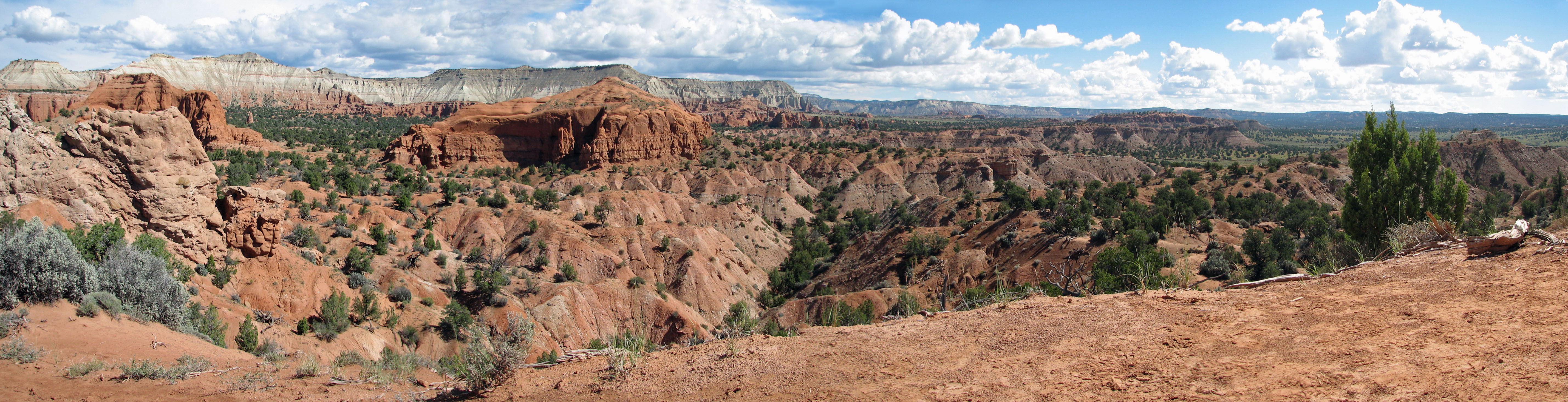
The next morning we drove to the Goosenecks State Park (SP) basically a parking lot overlooking a huge snaking gorge created by the San Juan river several thousand feet below. Then we did a much more interesting 16 mile drive through the Valley of the Gods where we got our first look at mesas, rocks precariously balanced, various erosion formations and spectacular vistas. The afternoon was spent poolside with a stroll to the banks of the San Juan river.
Panoramic vista driving to Goosenecks SP
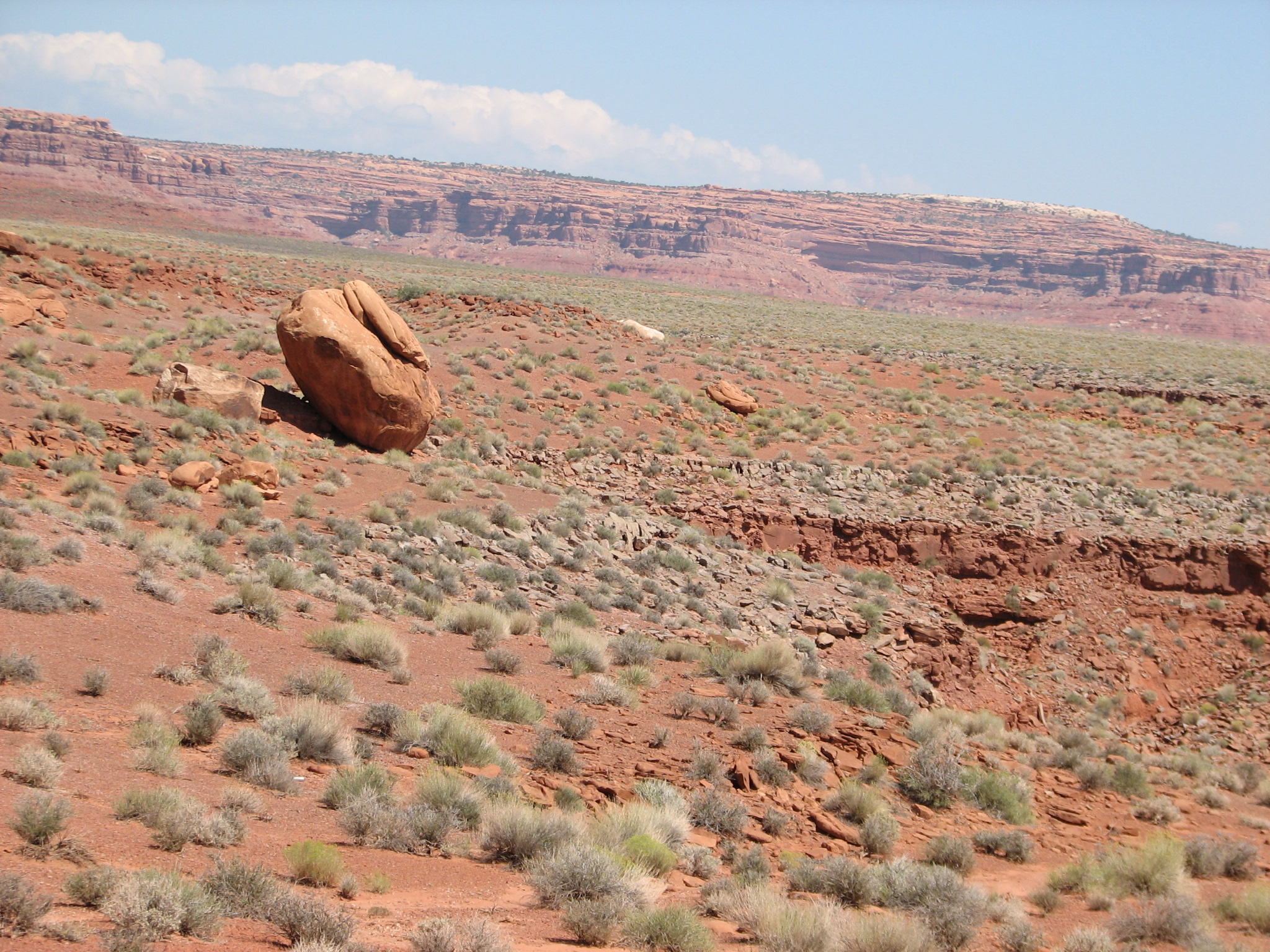
Valley of the Gods: One day you are at the top of the world, then ....
September 10
Leaving Bluff, we drove to Natural Bridges NM, taking the six mile trail in the river bottom between Sepapu Bridge and Kachina Bridge. This bed had cut several hundred feet below the desert above. Despite no water in the river there was plenty below the surface to make this wonderful hike through a green oasis. We were treated to petroglyphs when we arrived at Kachina. Back on the park road we drove to the Owachomo Bridge overlook before heading to Blanding. Blanding has a wonderful museum with lots of artifacts as well as Pueblo ruins behind the building.

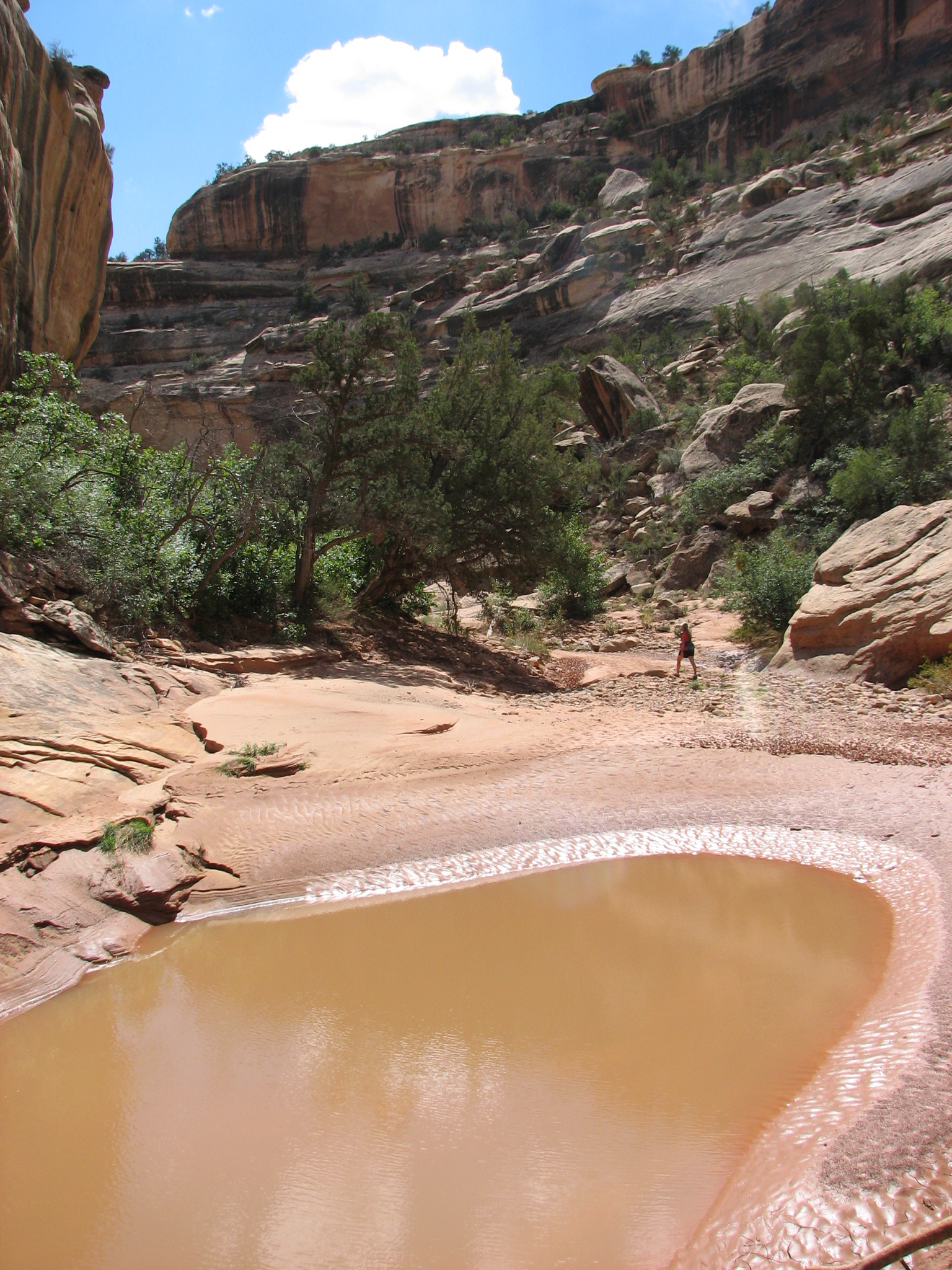
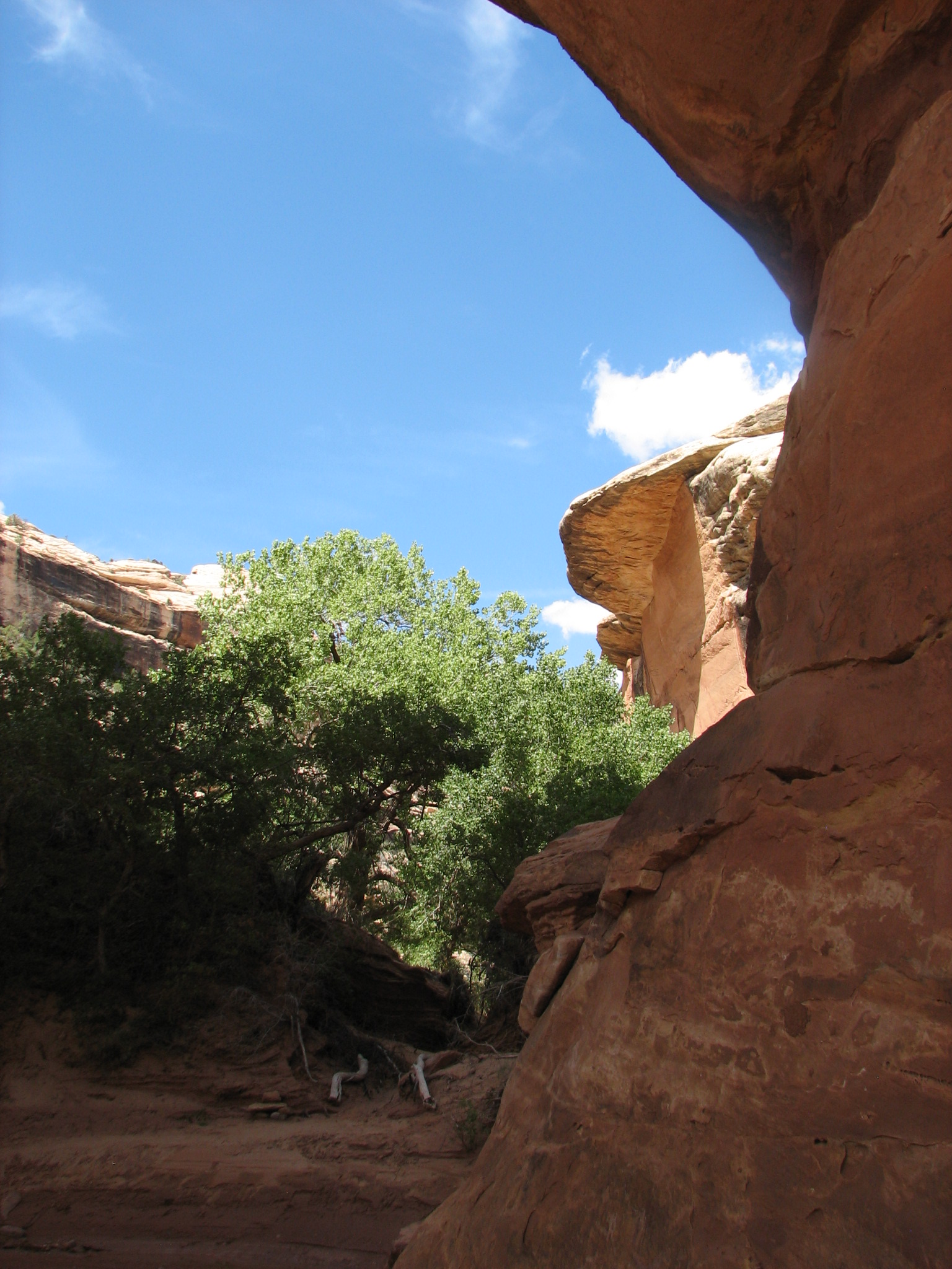
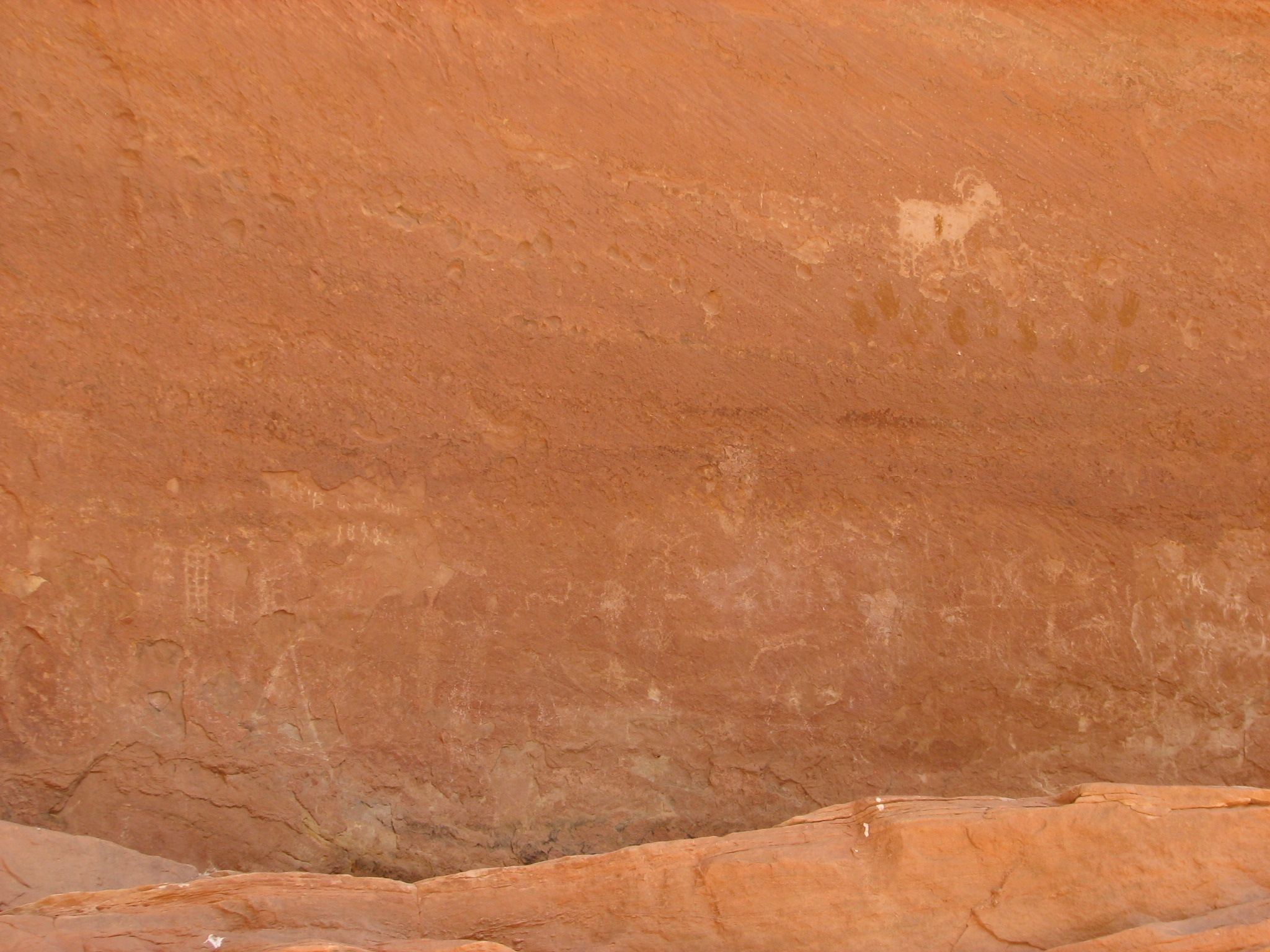

Sipapu Bridge River bottom Kachina Bridge Kachina pictographs Close up
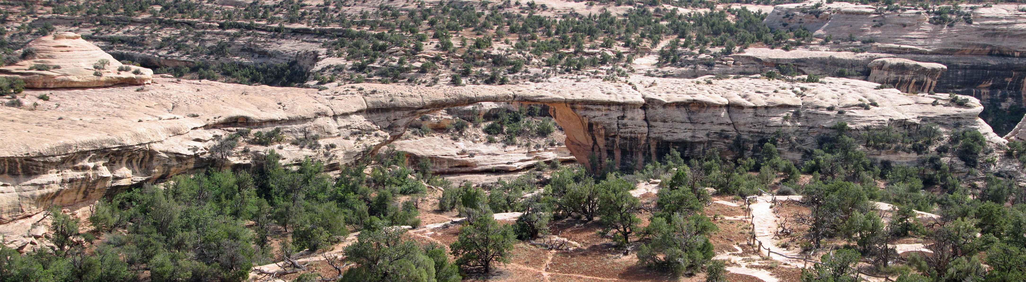 Owachomo Overlook
September 12
We drove from Blanding in our first rainy day yesterday afternoon. We took this as an omen and checked out Castle Creek winery just outside Moab. The tasting room was warm and dry. This morning we are back to fabulous fall weather allowing us to take several short hikes in Canyonlands (Upheaval Dome - 1.8 mi, Whale Rock - 1.2 mi, White Rim Overlook - 1.8 mi, and Grandview - 2.0 mi). Each was so different it was impossible to pick “Best Trail”.
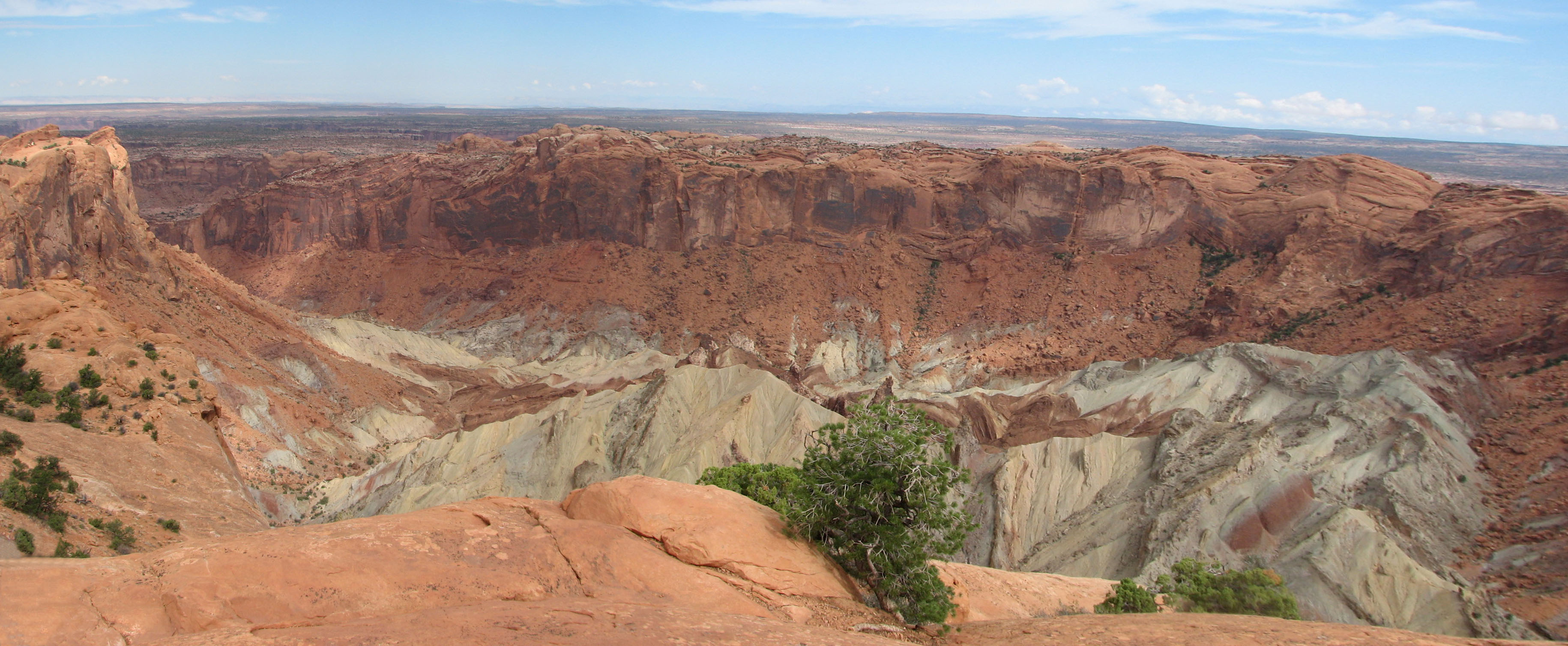 Upheaval Dome
 Whale Rock
 Grand View, 50 to 75 miles, I think.
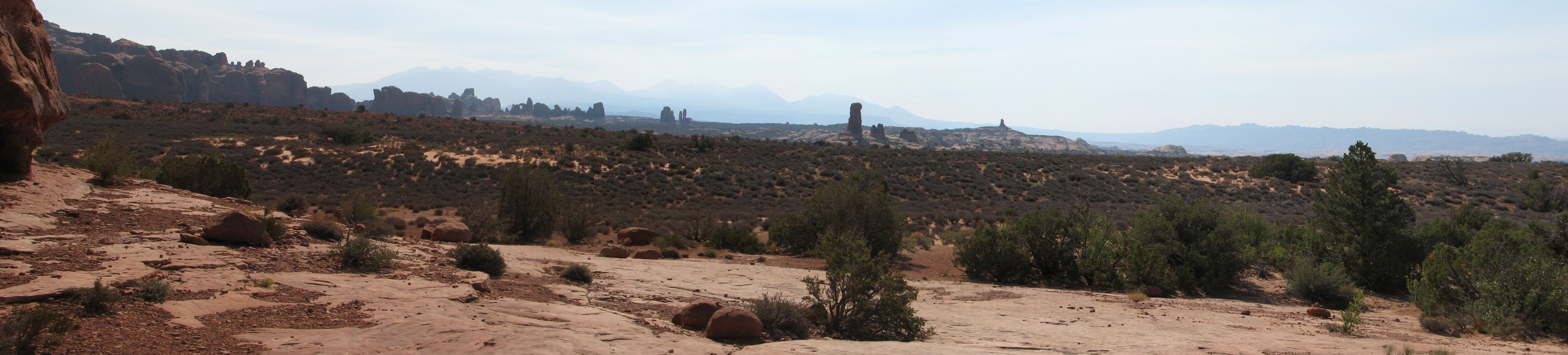
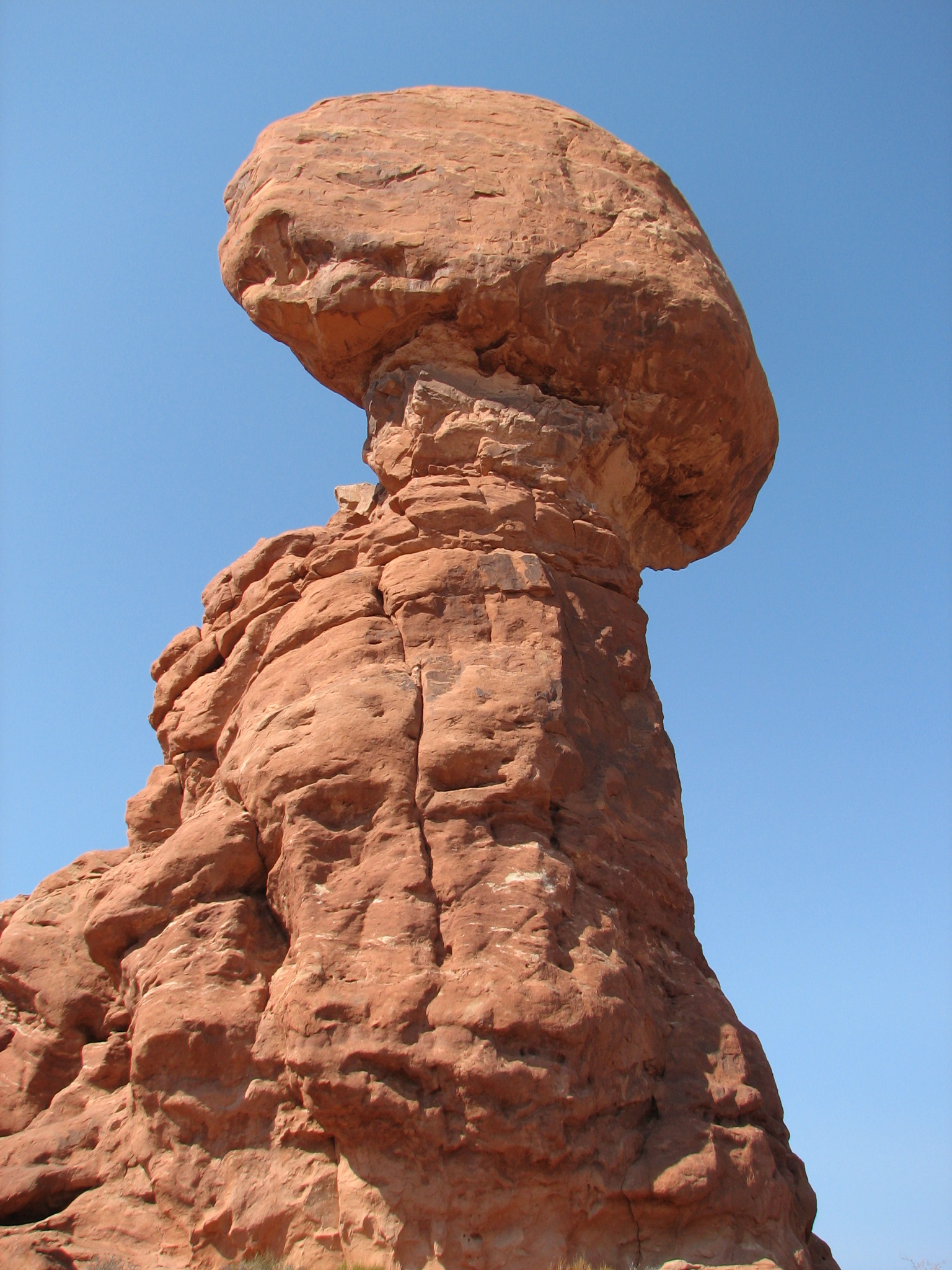
Arches NP is also reached from Moab. We did a half day there to save energy for a long hike tomorrow. We drove here and there doing short trails to Turret Arch, North and South Windows, as well as Balanced Rock. We went to Delicate Arch Viewpoint, but did not take the trail. In the 90’s part of the right half of Delicate collapsed shortly after a group sitting under it scurried out of harm’s way. A pebble at a time the static monoliths crumble. Our afternoon was spent cruising the shops and gathering solar energy at the pool.
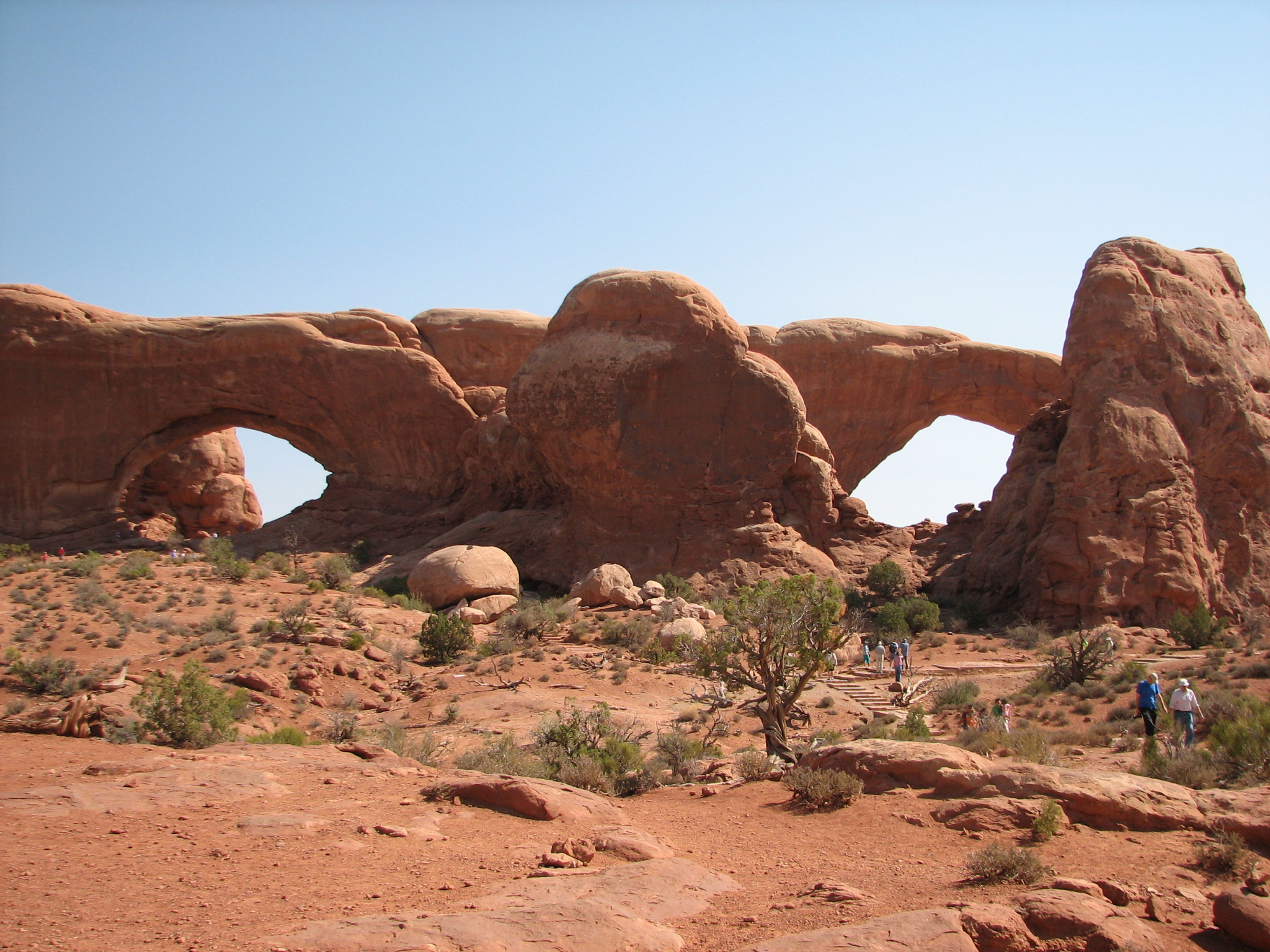
Balancing Rock North & South Arches Delicate Arch Double O Arch
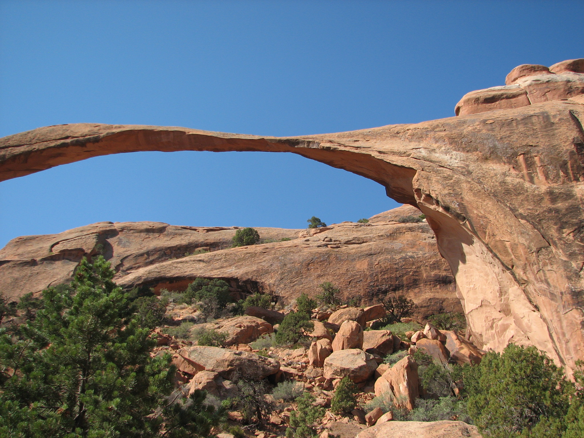
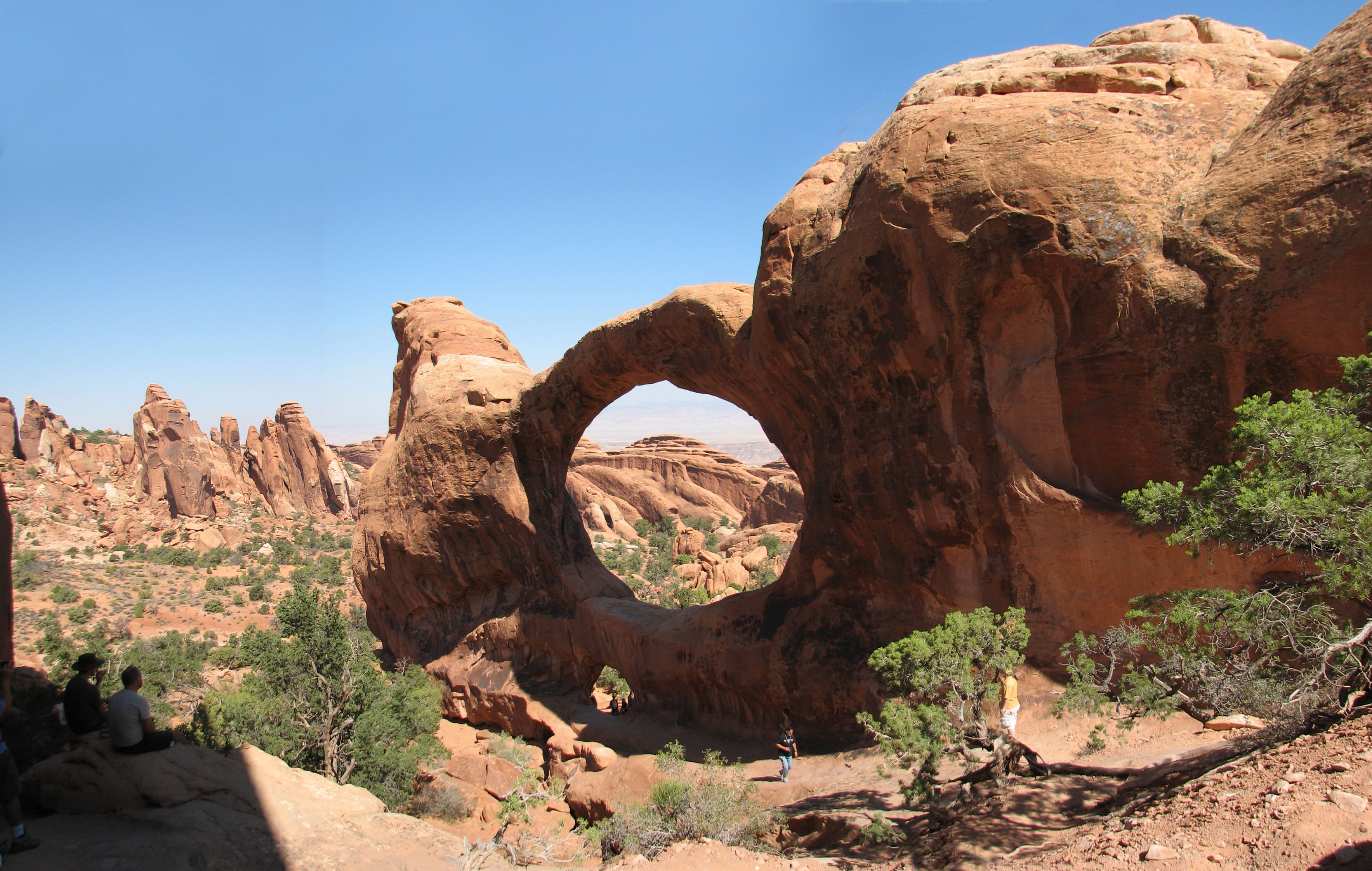
On the 14th we went back to Arches and did the 7 mile Devil’s Garden Trail, taking all of the spur trails to the various arches: Tunnel, Pine Tree, Landscape, Partition, Navajo and Double O (Martie’s favorite). We also hiked to Dark Angel, but it proved to be an obelisk, not an arch. Took the primitive trail back, managing the whole loop in about five hours, including our cliff-side leisurely lunch.
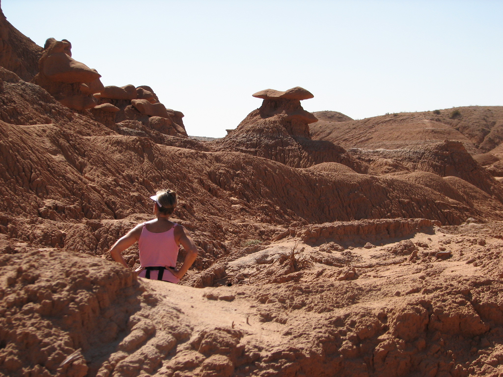
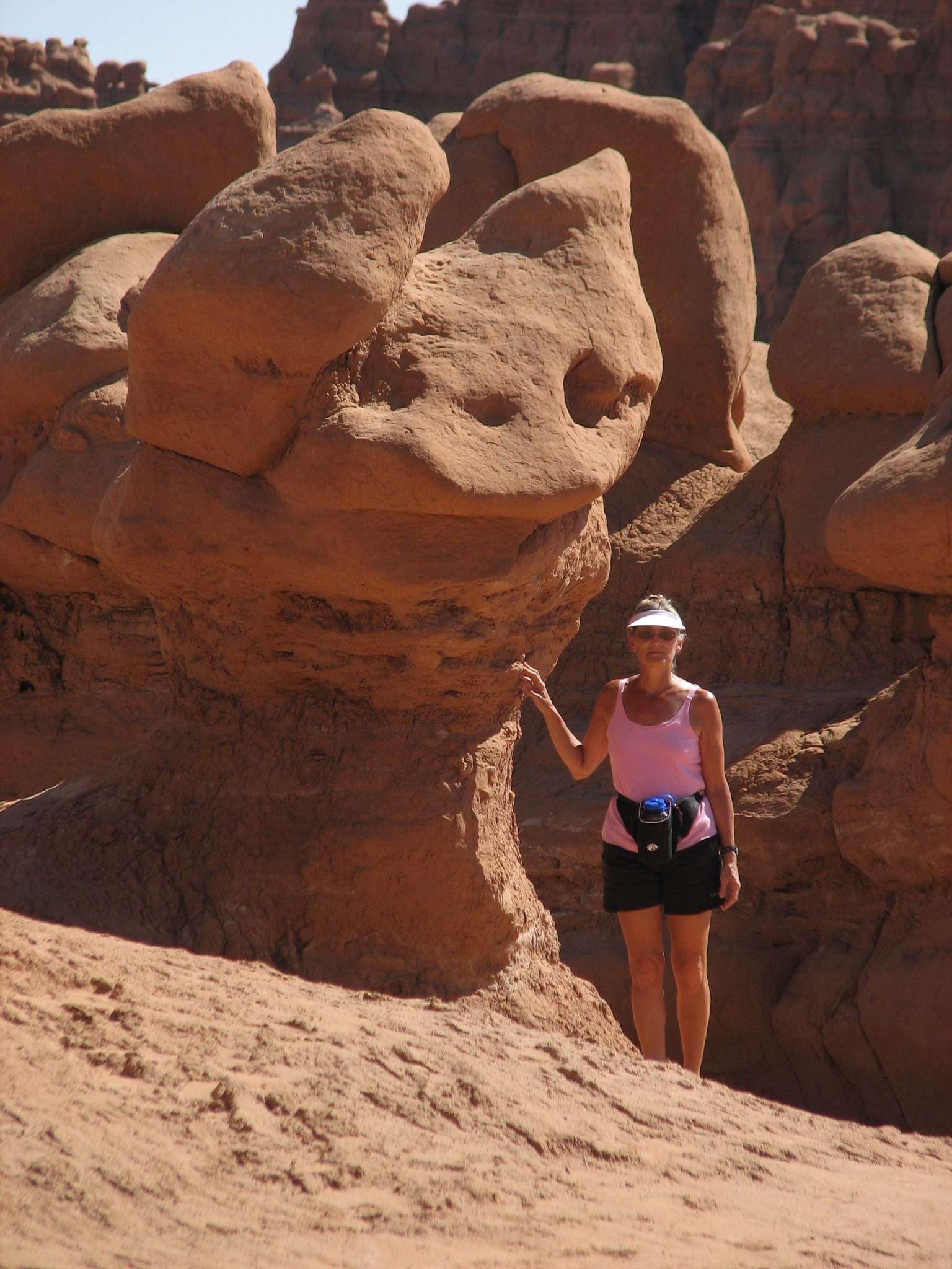
Leaving Moab the next morning we found ourselves in Green River at lunch time during their much acclaimed watermelon festival. To our untrained palate this much touted melon did not taste significantly different than those available at home. West and South of Green River off hwy 24 lies one of our favorite campgrounds, Goblin Valley SP. This place is about 5 miles beyond the middle of nowhere and our campsite was hidden behind bluffs from the general loop. The one campsite nearest was vacant our second night. There was no, I repeat, no ground clutter light and the stars were unbelievable in the cool, clear air. We hiked the Entrada Canyon trail through Goblin Valley to Molly’s Overlook. The goblins are queer little erosion formations showing that Mother Nature has whimsy.
 Goblin Campsite
 Entrada trail
 A Goblin
Next morning found us hiking Cohab Canyon in Capitol Reef NM. Once past the switchback slog up top, this was a pretty little canyon with several slot canyons to explore. After lunch we drove down Scenic Drive (Duh!) to the Capitol Gorge trailhead which led 2.5 miles to the Tanks, a series of natural holding ponds formed in the underlying granite.
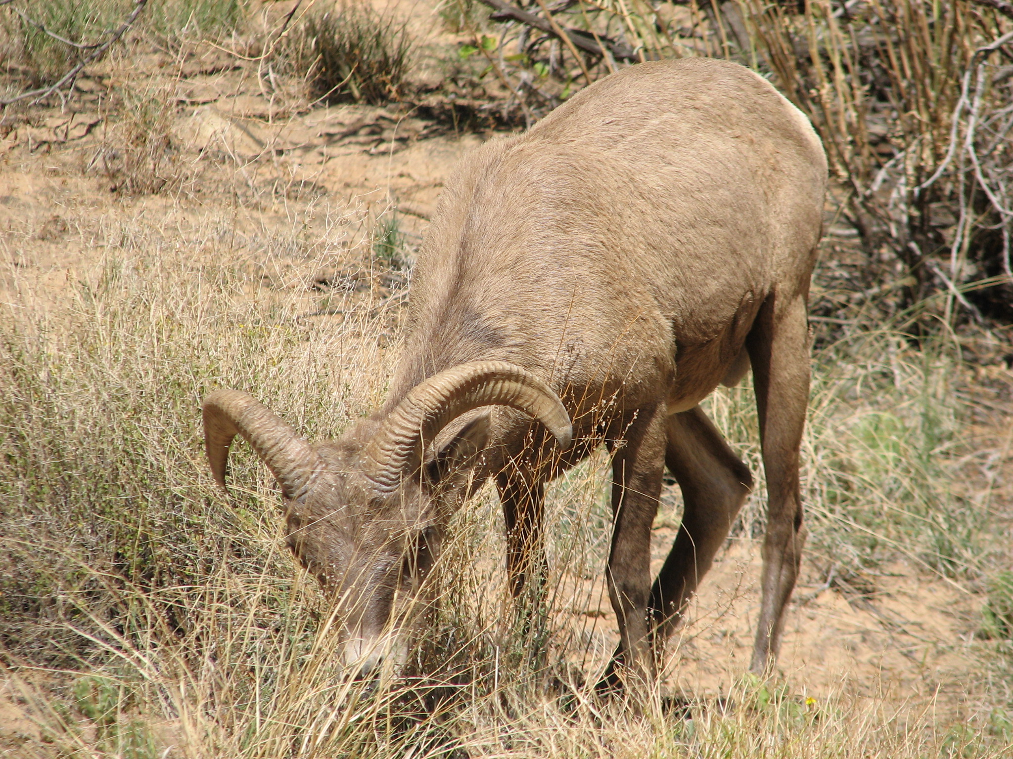 Wild sheep at Gorge trailhead
 In route to the Tanks
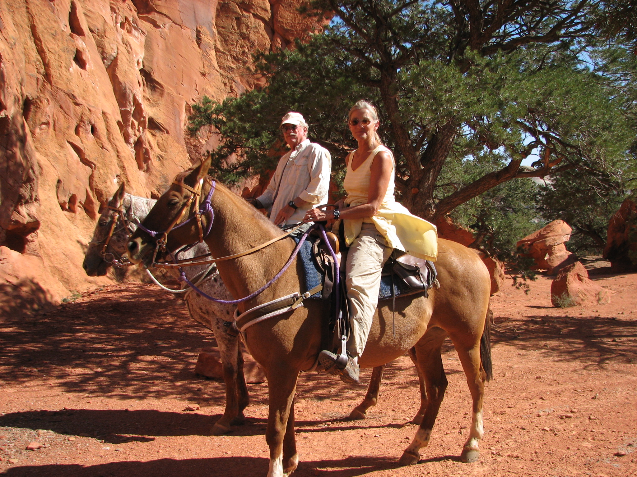 On the afternoon of the 18th we
went horseback riding with Back Country Outfitters. It was a nice change of
pace. Our guide, Lacy, was quite the cowgirl. As we covered a lot of ground
she gave us some information about what we were seeing. I was not nearly as
tired as the horse after this outing.
On the afternoon of the 18th we
went horseback riding with Back Country Outfitters. It was a nice change of
pace. Our guide, Lacy, was quite the cowgirl. As we covered a lot of ground
she gave us some information about what we were seeing. I was not nearly as
tired as the horse after this outing.
Back at the Capitol Reef Visitor Center early the next morning, we listened to a geology lecture given by a Ranger. It is hard to explore this area without wondering about the geology, but keeping strata and rock types straight is daunting. There is no wonder I am not a geologist. Seems there is history in those rocks --- 50 million years of it all laid bare from the heights of Capitol Reef to the bottom of the Grand Canyon --- just waiting to be read. Don’t get me wrong. The lecture was interesting and informative, but not much stuck except for one thing: 50 million years ago Utah was lying on the ocean floor minding its own business when some tectonic collision shoved it up and out. For the last 50 million years wind and water have combined to create all of the wondrous things of beauty across this region and is continuing to do so even now. The word is that you better go see Utah now because in 5 million years it won’t be worth the trip. It will have eroded away to nothing.
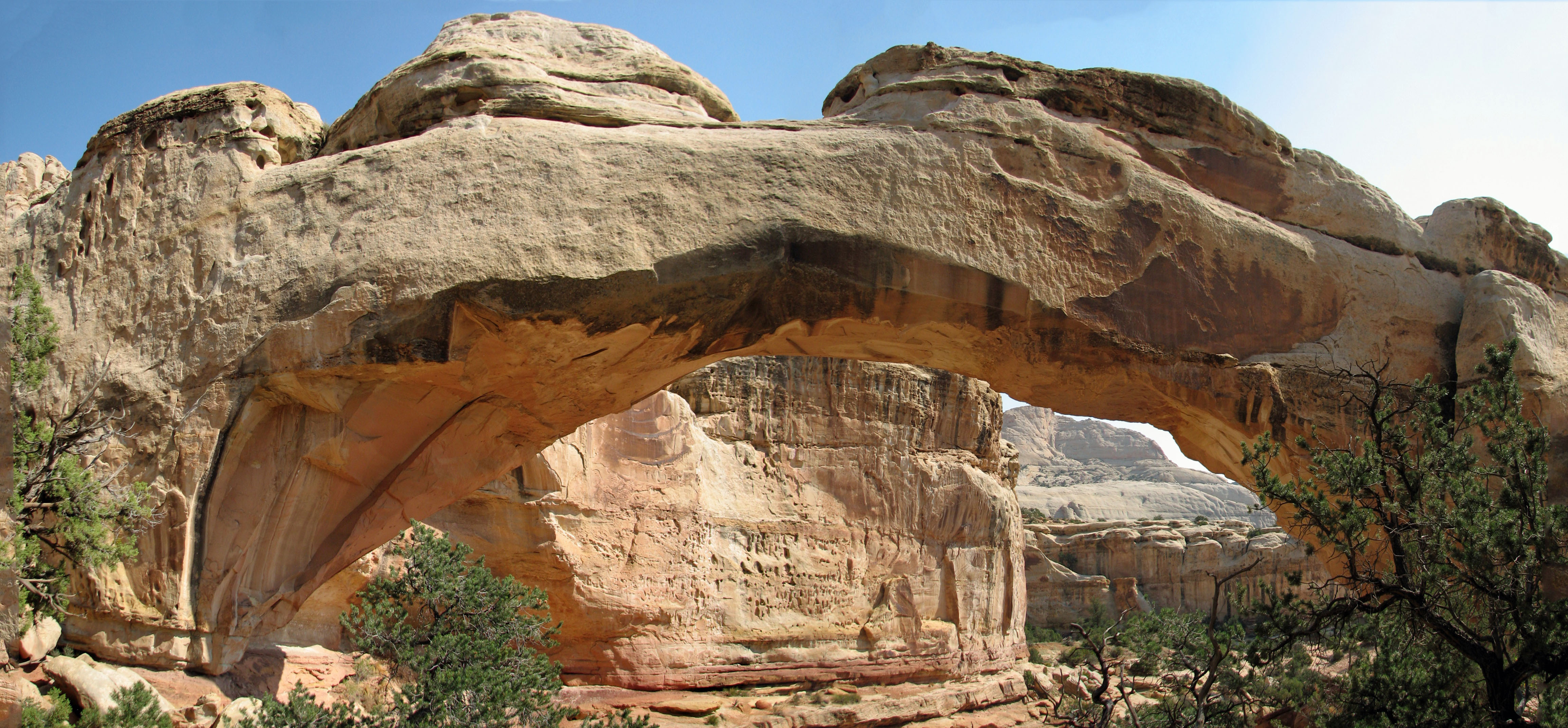 We finished the morning with a nice hike to
Hickman Bridge. After lunch we drove to the Old Wagon Loop Trail which was
supposed to culminate in “panoramic views of the water pocket folds.” We
found nothing that looked like Martie’s postcard, but it was a quiet,
solitary hike.
We finished the morning with a nice hike to
Hickman Bridge. After lunch we drove to the Old Wagon Loop Trail which was
supposed to culminate in “panoramic views of the water pocket folds.” We
found nothing that looked like Martie’s postcard, but it was a quiet,
solitary hike.
September 21
This Friday was a lazy day. We finished Capitol Reef by checking out the Sulfur Creek goosenecks and checked out the view from Panorama Point. Then it was grocery shopping, laundry, email and reading by the pool.
On Saturday we were off to Escalante, but first we took in the Anasazi State Park museum and archeological remains of an ancestral Pueblo village. (You will learn that “Anasazi” is an incorrect appellation. These ancient people are now being called “ancestral Pueblo Indians.” In time this information will reach the Powers-that-be in the park system and the park will get a politically correct name.) The drive from Torrey to Boulder was high enough for the aspens to have put on their fall yellow. What the eye beholds cannot be conveyed by the camera unfortunately.
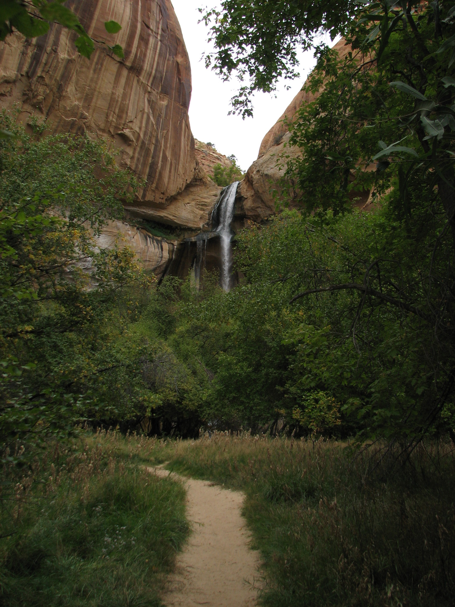
From Boulder to Escalante we drove through legendary geological beauty, but were unimpressed. We had seen much more dramatic landscapes in Canyonlands and Capitol Reef. We spent two nights at the Escalante Petrified Forest SP. They had a 1.75 mile trail through the woods around displays of petrified wood. (And no, we never learned what they scared of.) We also drove hwy 2 to the Calf Creek RA taking a six mile trail to a beautiful 120’ falls. On the yellow cliffs to the right across the creek are three red petroglyphs that are larger than life.
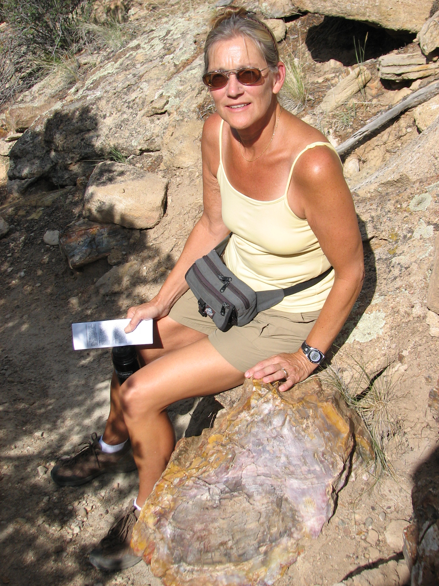
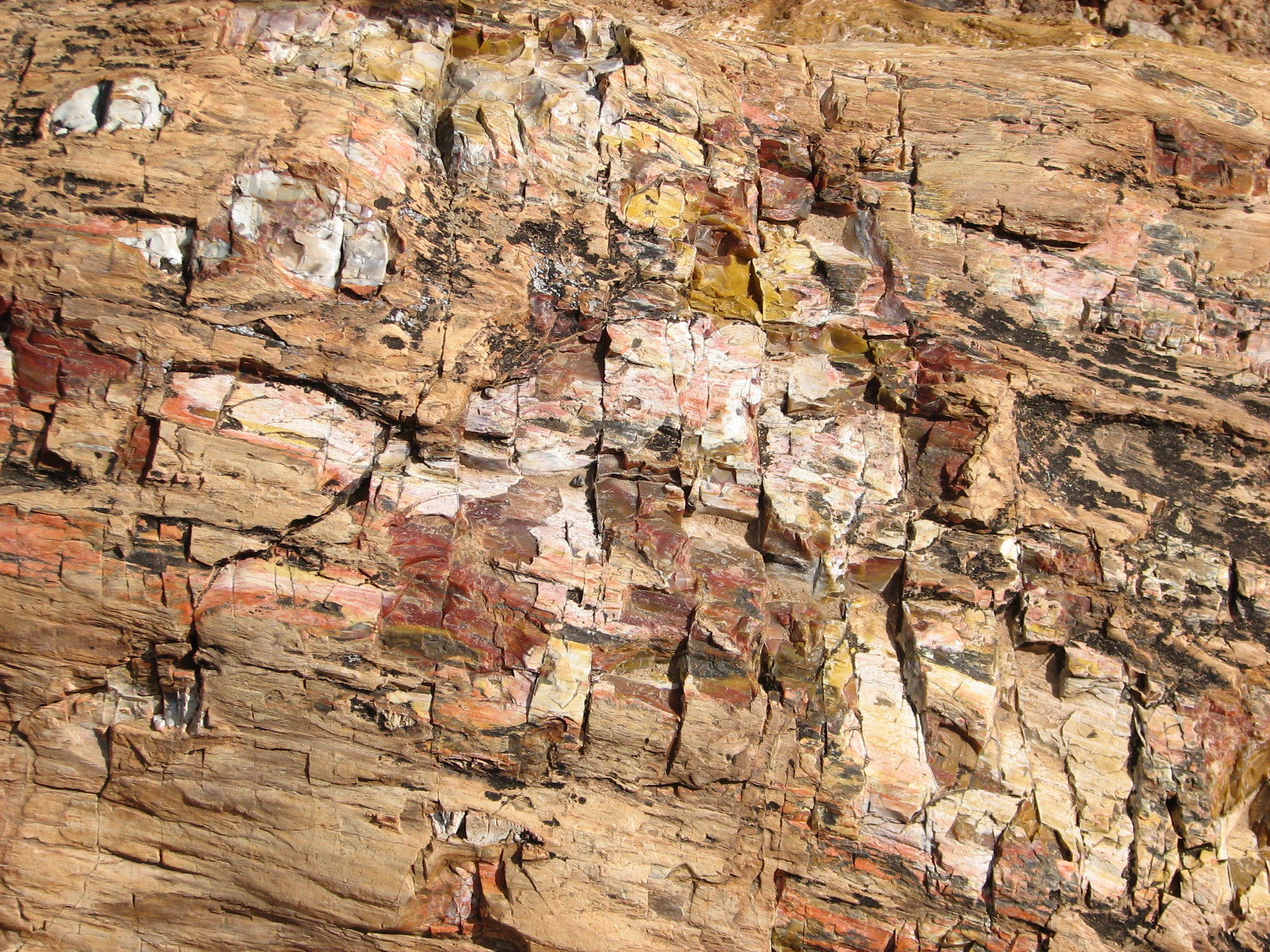
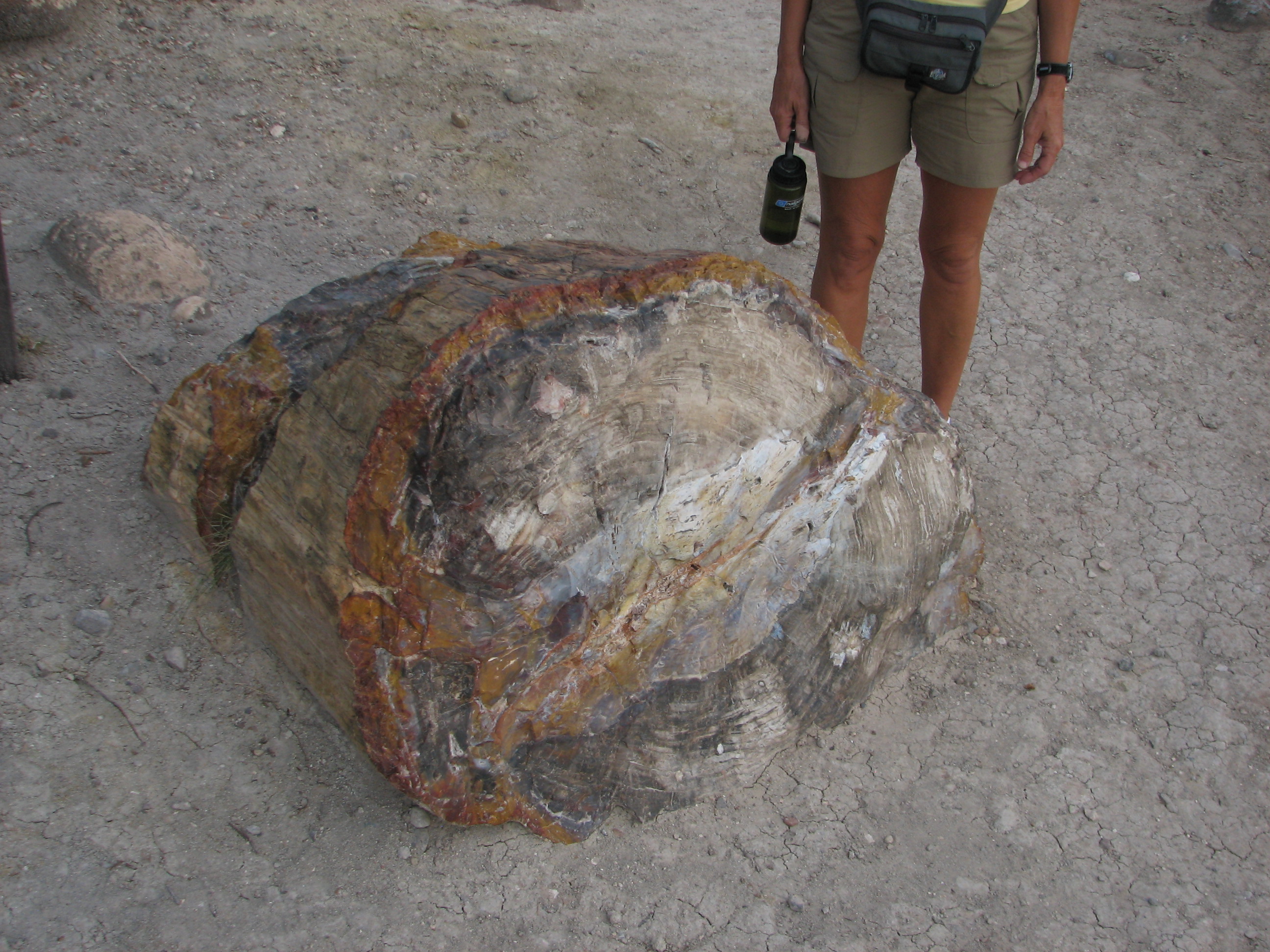
Petrified wood Wood close up Huge piece Interesting factoid
 Approaching
 Calf Creek Falls
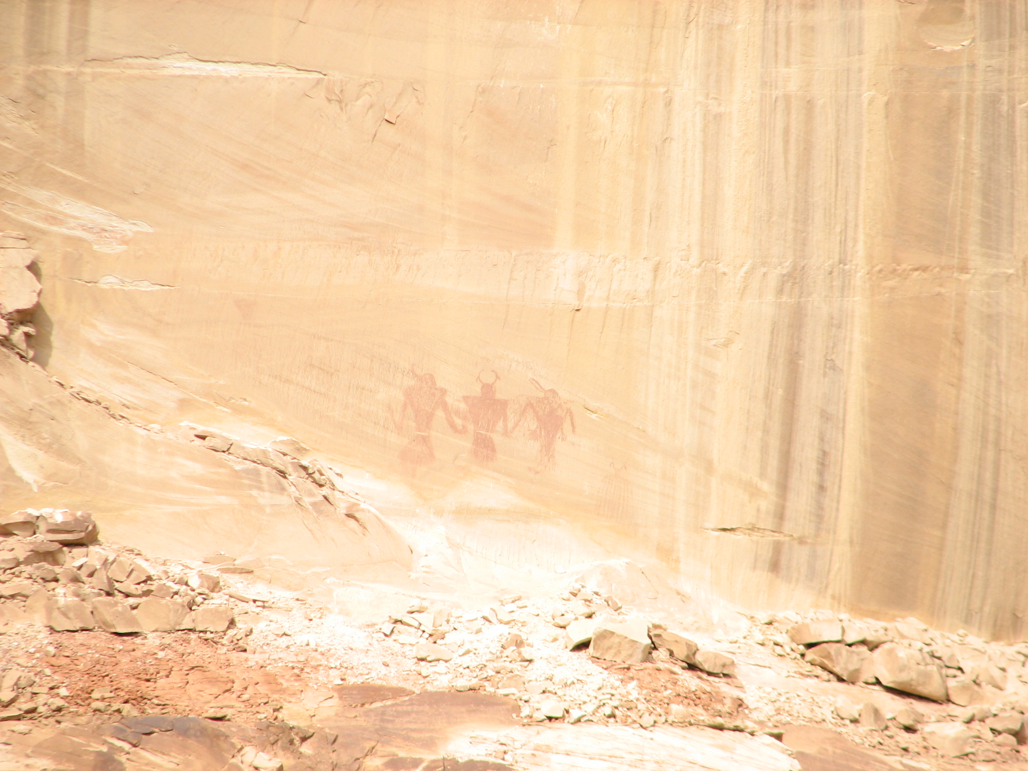 Petroglyphs, 1/2 mile away
September 25
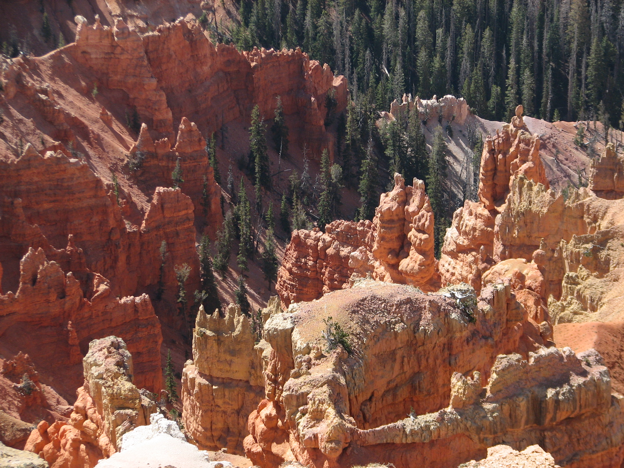
We set up camp last night in Kodachrome Basin SP and enjoyed rain showers off and on all night. Unsurprisingly the morning was gloomy, so we drove to Bryce Canyon NP and did all the overlooks. Sometimes we saw only fog, but most of the overlooks were clear but with limited visibility toward the horizon. Although one can walk in the canyon bottoms at Bryce, its natural wonders are more spectacular looking down. Zion NP will provide the opposite experience.
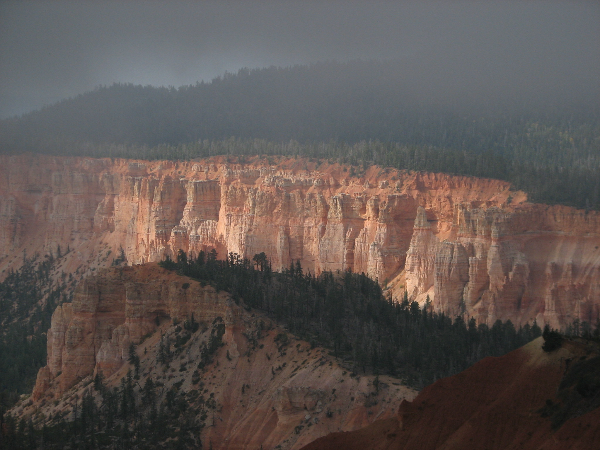
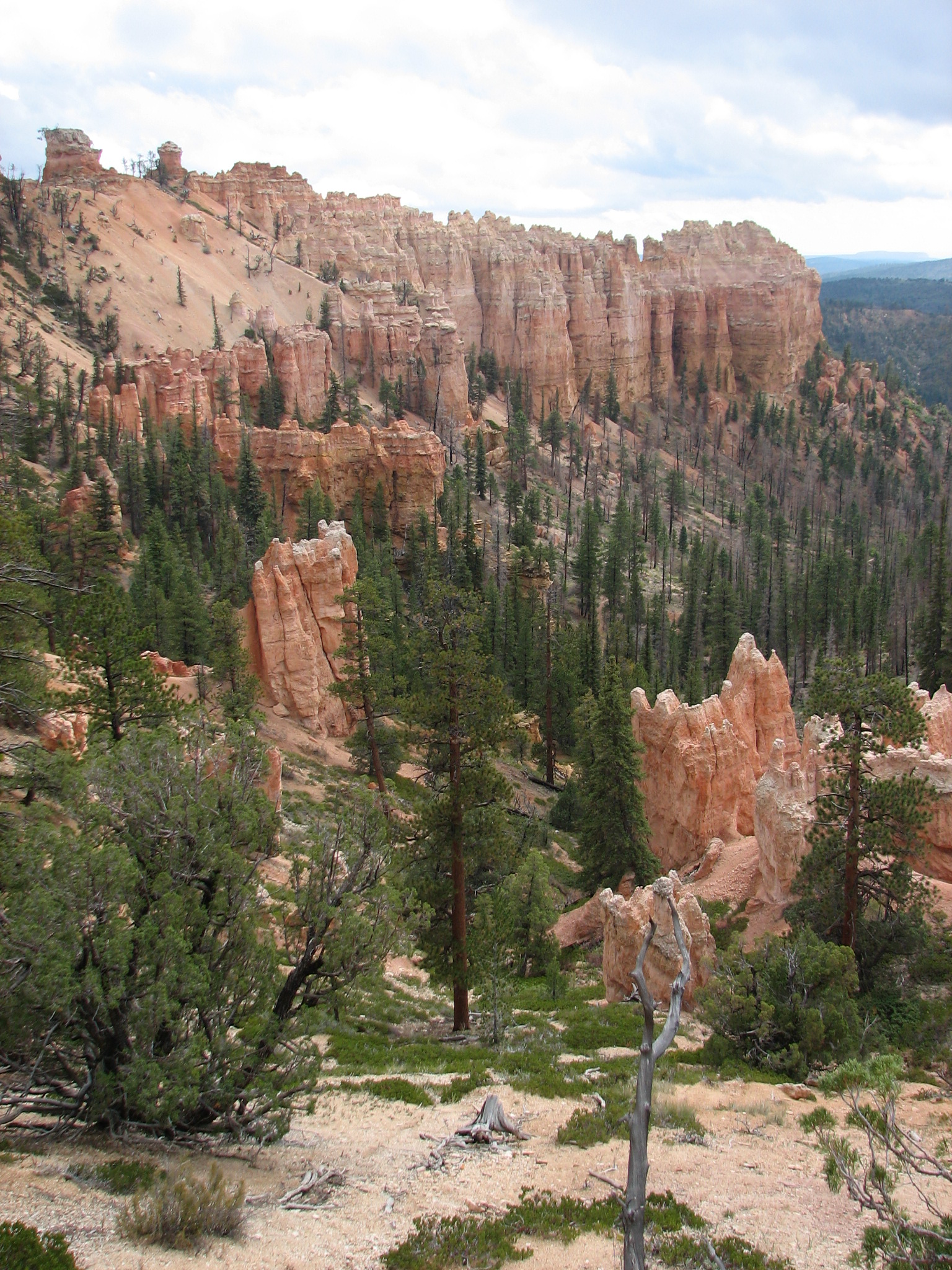
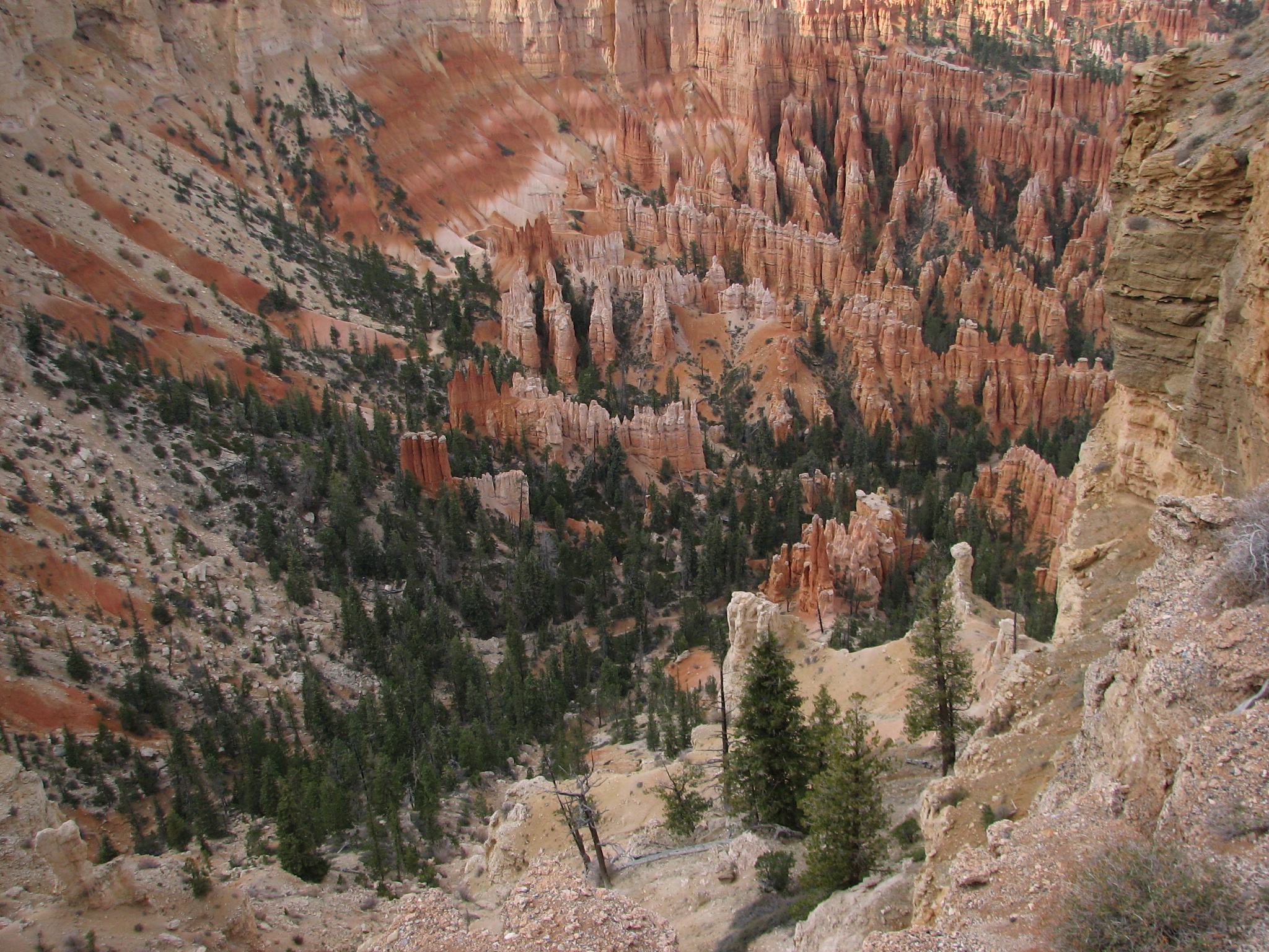
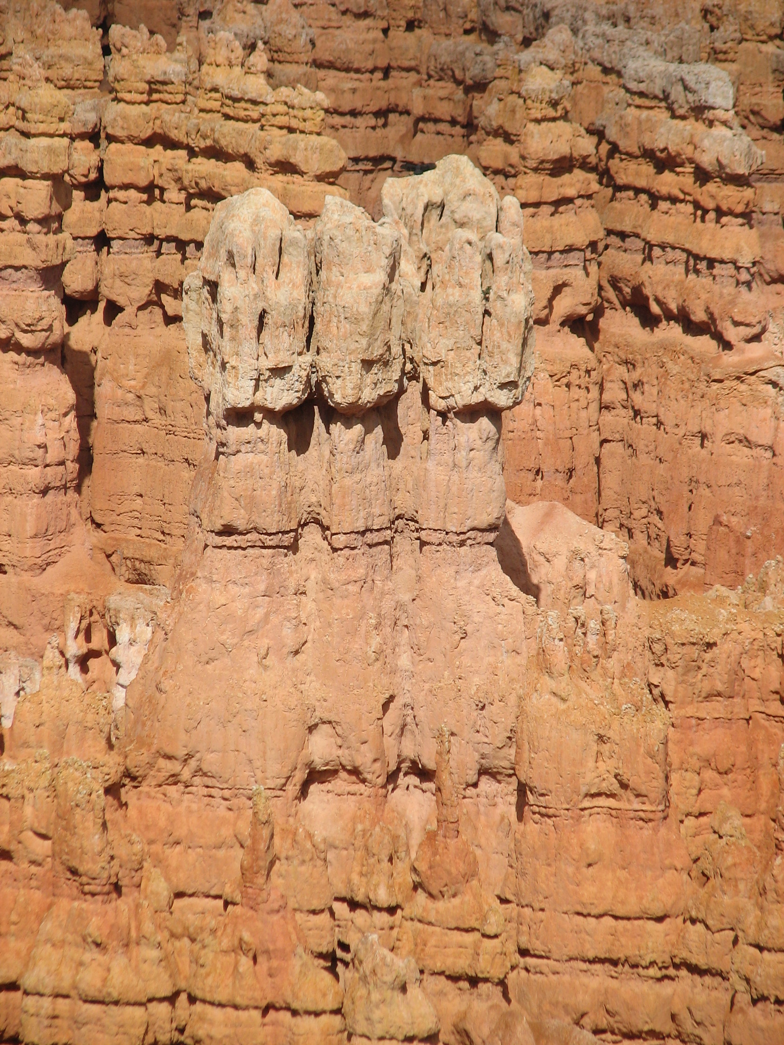
Bryce Canyon Overlooks
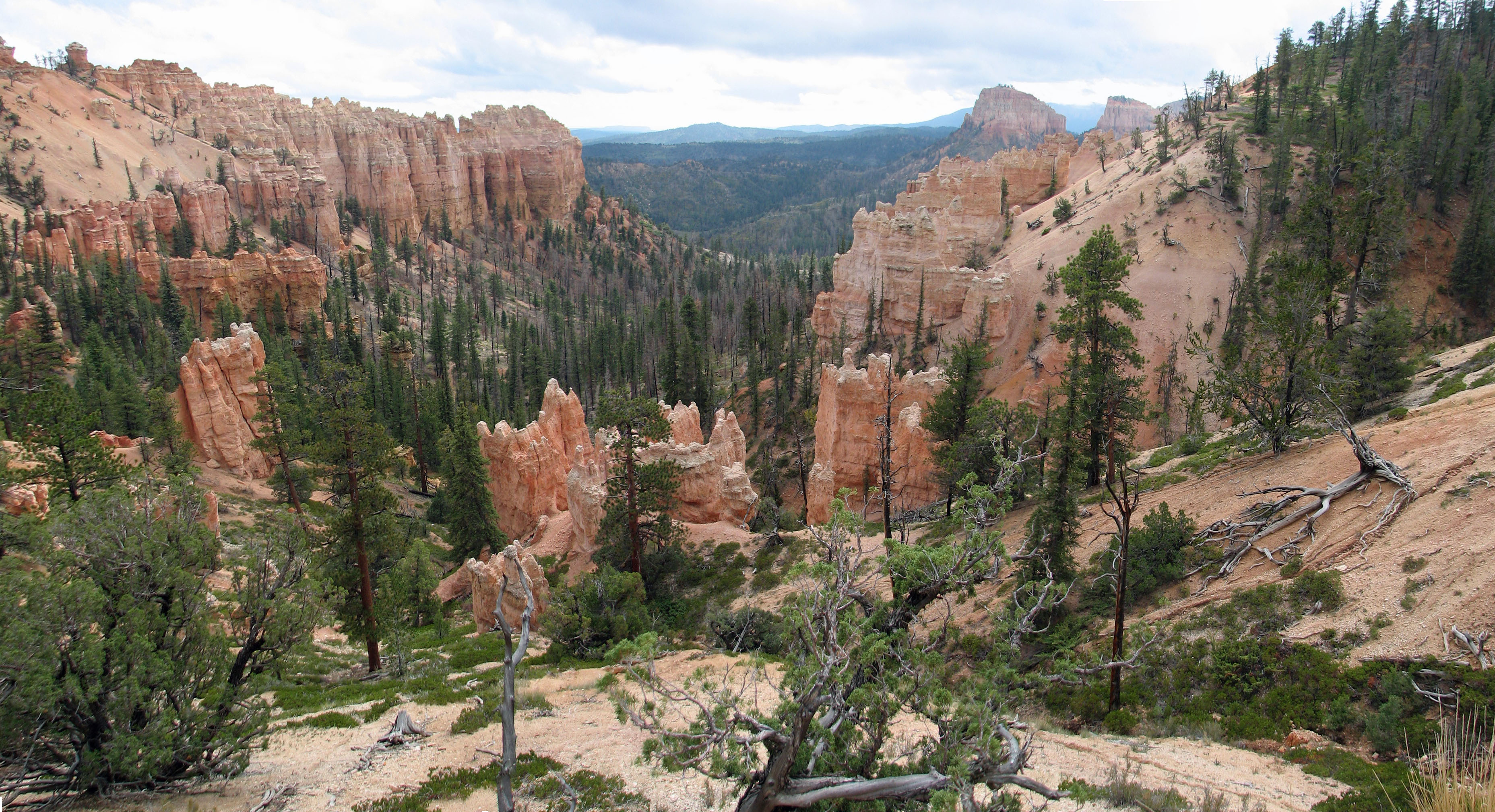
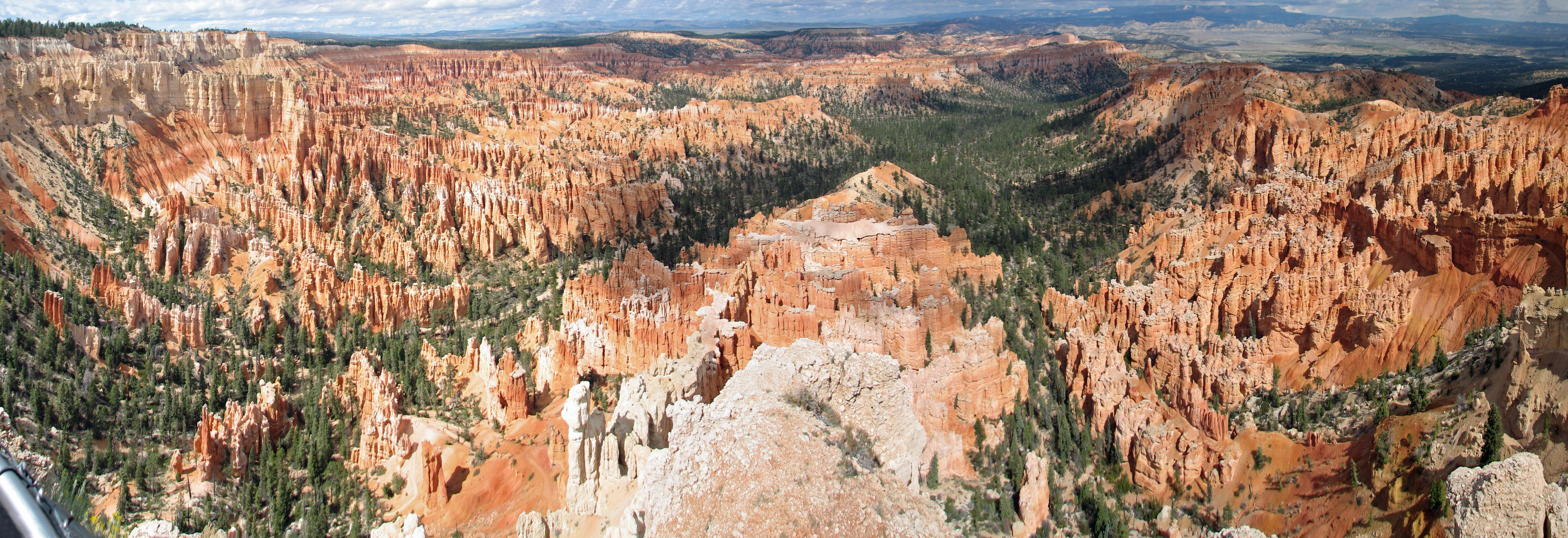
Bryce Canyon Panoramic Views
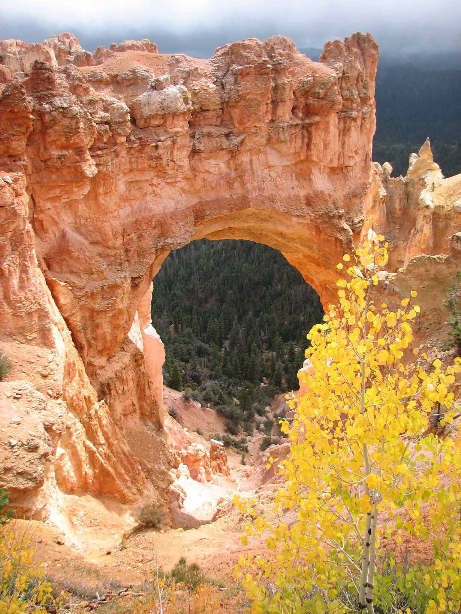
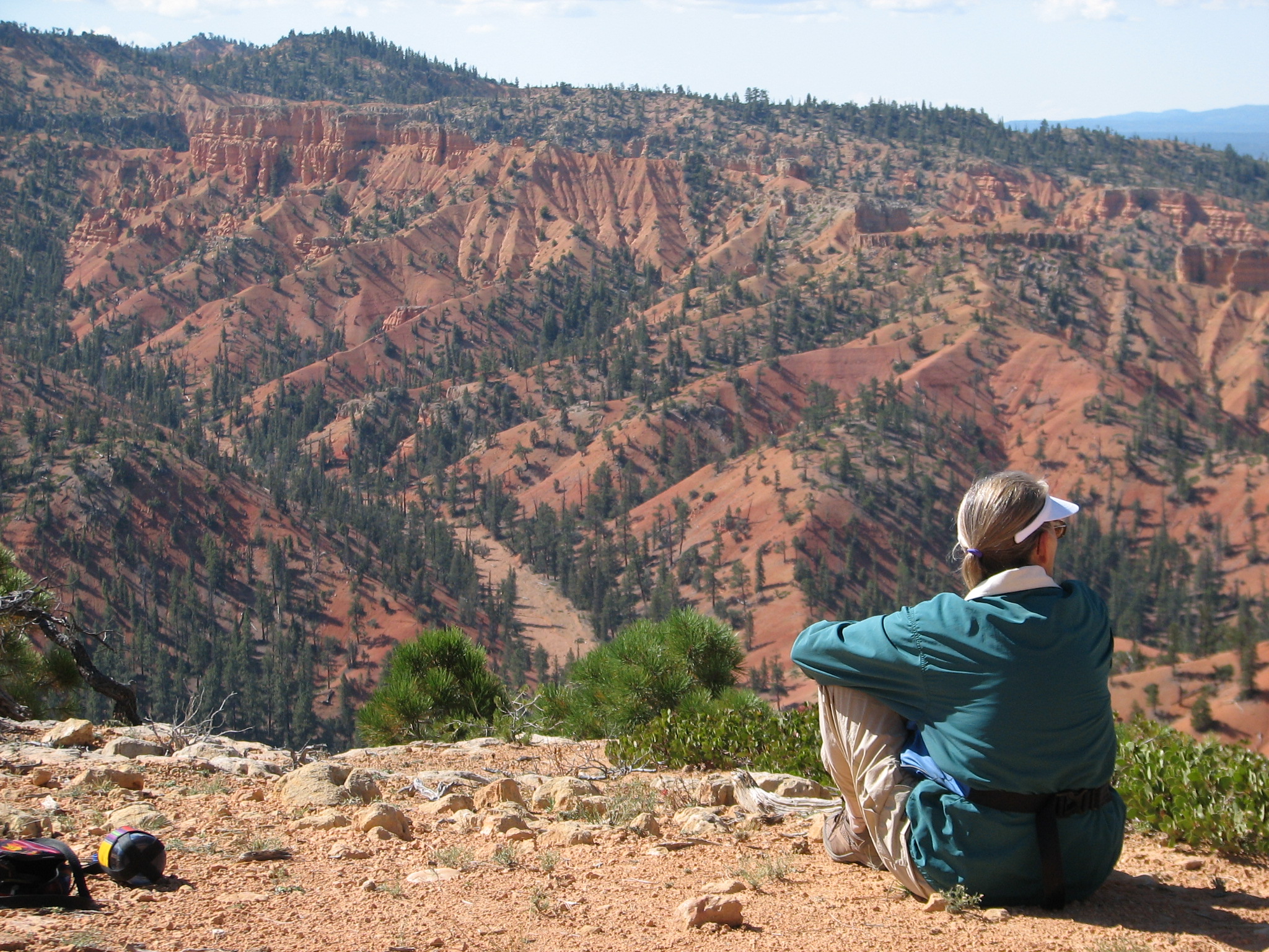
Our second day was spent exploring Kodachrome. In the morning we hiked the Panorama Trail (panorama may, deservedly, be the most used trail name in southern Utah) and after lunch we travelled the Shakespeare Arch/Sentinel trail and Angel’s Palace. Our third morning found us eating breakfast at Clark’s Restaurant before making the short drive to Dixie NF, Red Canyon area. We hiked most of the Rich trail and all of the Ledge trail returning in time to drive to Panaquitch for lunch at a famous barbeque restaurant. It didn’t open for lunch, so I had to settle for liver and onions at the Flying M. On our way back we did a short 1 mile Arches trail in Red Canyon. This trail featured a fin with maybe a dozen arches/holes within a few hundred yards; something quite unique I think.

Views from Panorama Trail, Kodachrome Basin SP
 Red Canyon vista
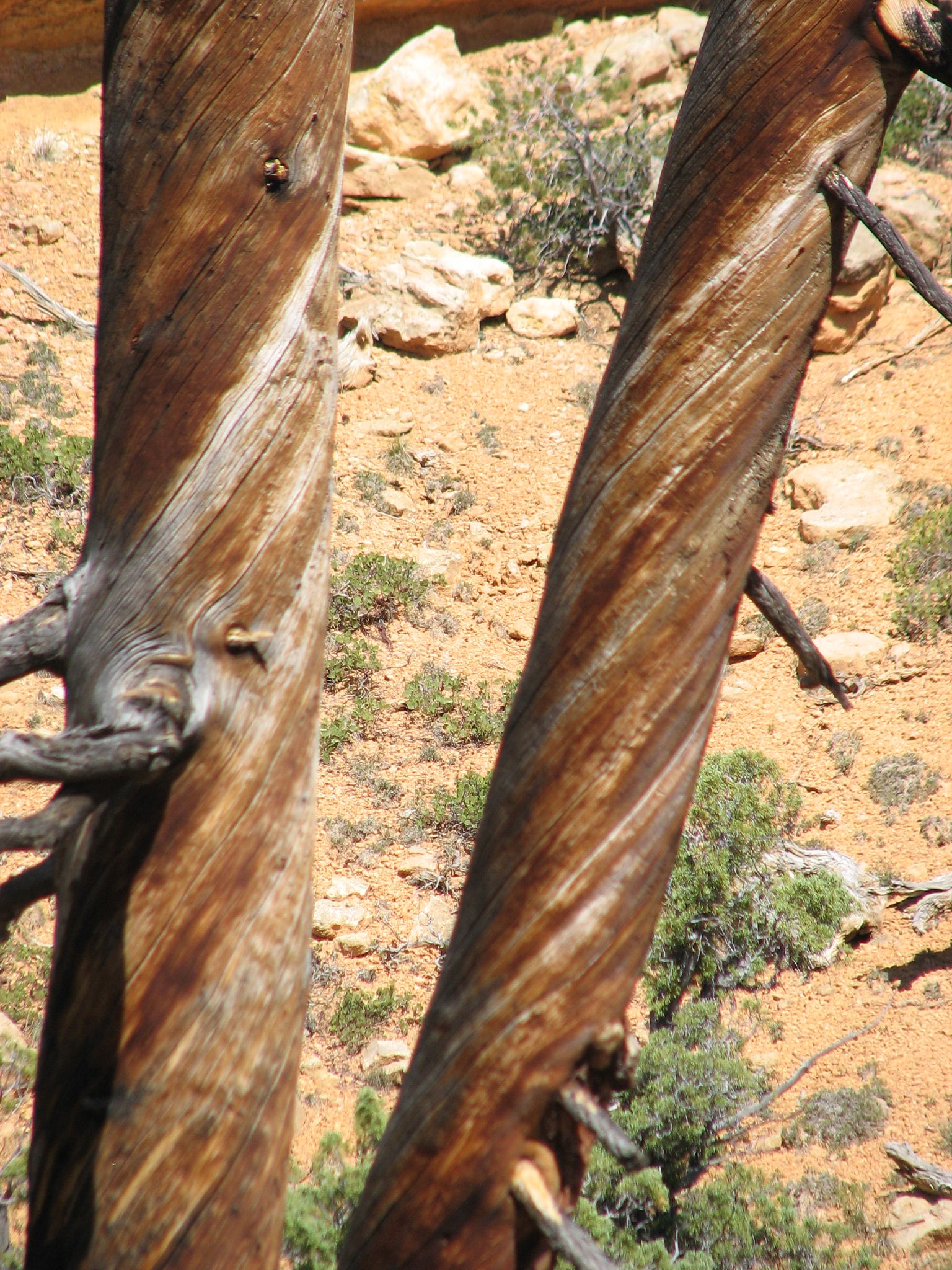 Twisted pines
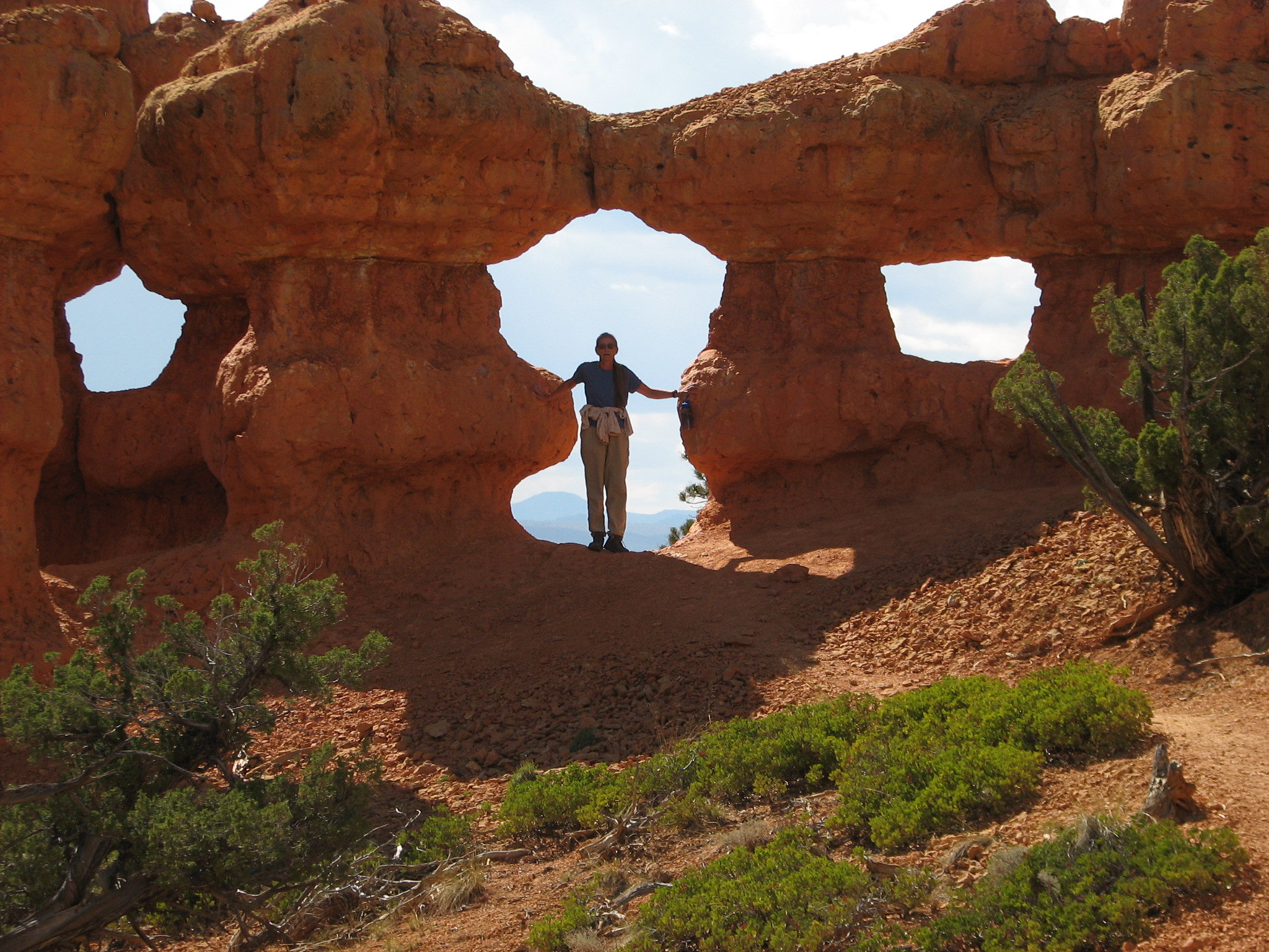 Holey fin
September 28
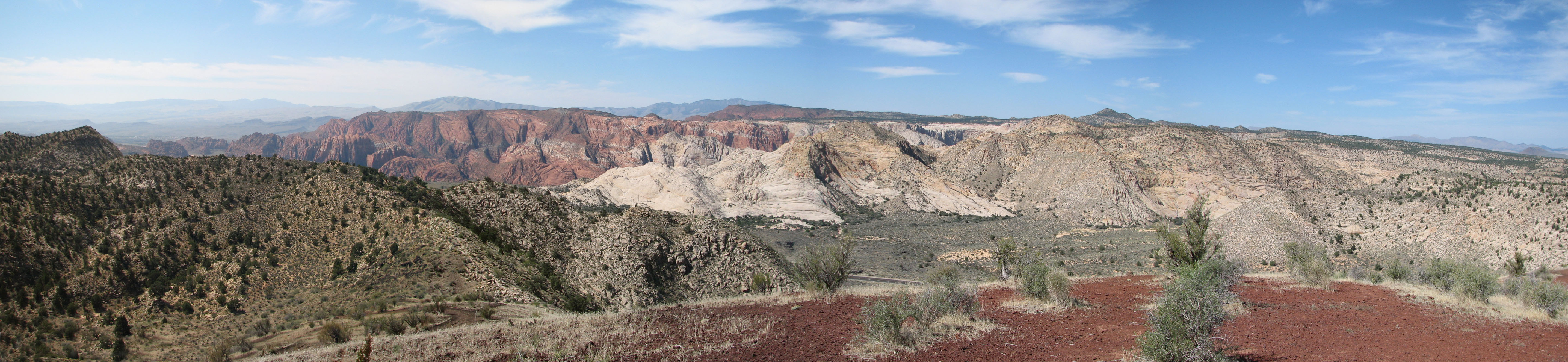
Left Kodacrome Basin, drove back through Panaquitch, then south in hwy 143. We cut across Mammoth Creek road to hwy 14and east into Cedar City. The traffic was minimal as we drove mostly woodlands, but there were numerous places where we saw boulder fields of lava rock – big dark grey rocks – several dozen feet high, but flat topped, not conical. Weird.
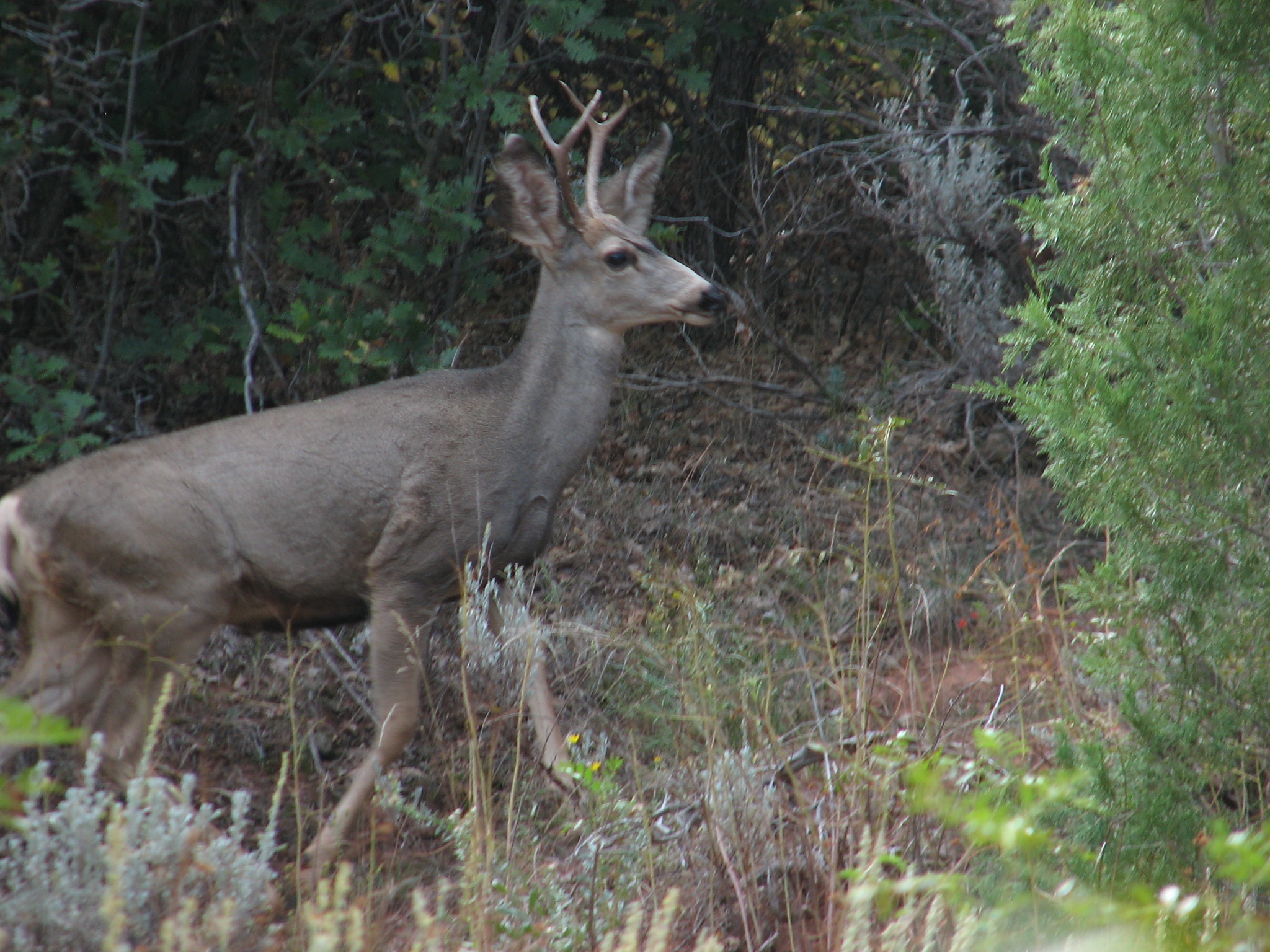 Out of Cedar City the next morning we went to
the North Entrance of Zion NP for a hike up the 5 mile Taylor Creek Overlook
trail where I shot a 4-point buck as it bounded out of the creek and across
our trail. Animal sightings on this trip have been rare and to be able to
photograph this guy was a lucky break. A short loop around Timber Creek
Overlook trail rounded out today’s explorations.
Out of Cedar City the next morning we went to
the North Entrance of Zion NP for a hike up the 5 mile Taylor Creek Overlook
trail where I shot a 4-point buck as it bounded out of the creek and across
our trail. Animal sightings on this trip have been rare and to be able to
photograph this guy was a lucky break. A short loop around Timber Creek
Overlook trail rounded out today’s explorations.
September 30
Today we did Cedar Breaks NM, first, hiking the Alpine Pond trail followed by lunch at the North Overlook. Driving back to the Visitor Center we took the Spectra Point/Rim Overlook trail. Not for the acrophobic! It was so cold and windy we turned back at Spectra Point. Near the Point is a 1600 year old piñon tree. I find it hard to imagine something 1000 years old when Columbus set sail.
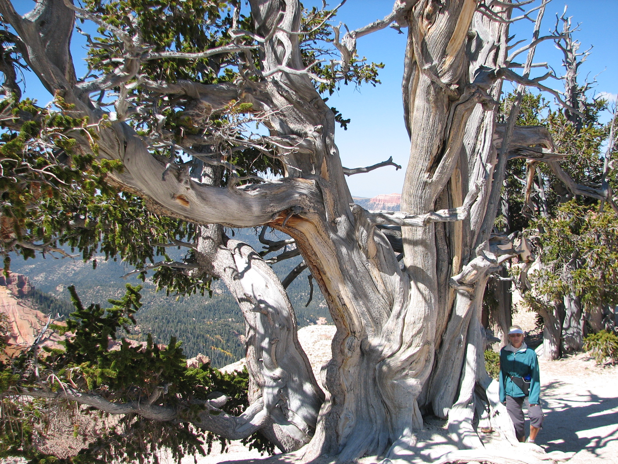
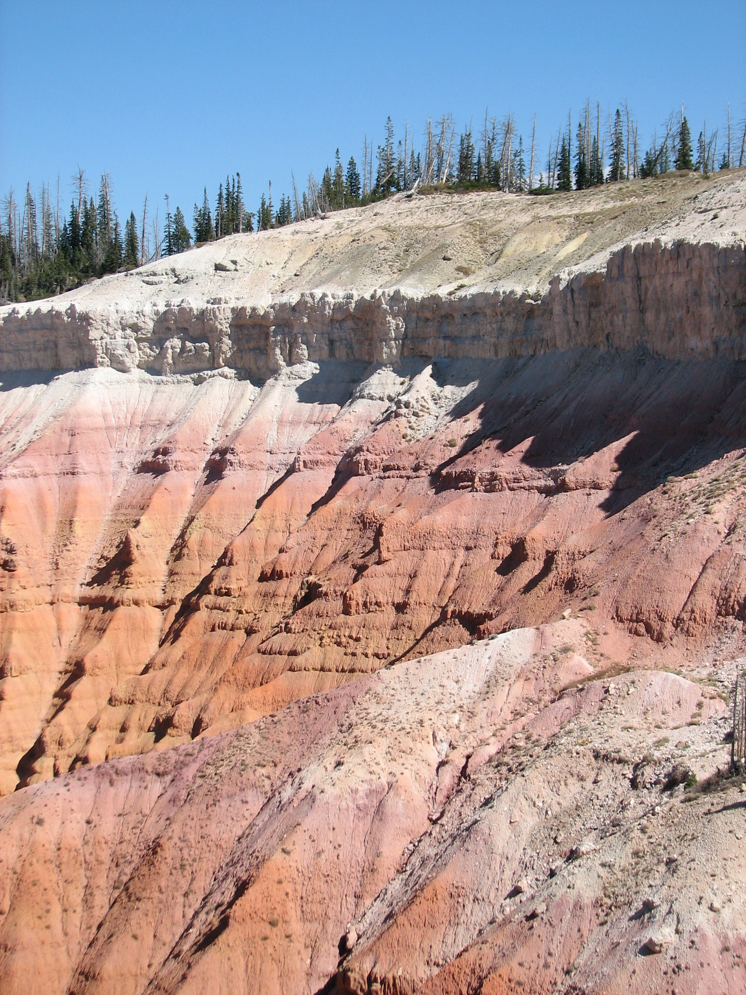
Alpine Pond Hoodoos Spectral Point Trail 1600 year old pine Trail near trees

The following day we drove to St George where we filled up the larder, took in the Dinosaur Discovery Museum (cool displays of bones and track found locally) and had lunch at Georges on Ancestor Square before driving to Snow Canyon SP. At this low altitude it was so hot we waited until the sun dropped behind the mountain before setting up camp. These were our last four nights of camping on this trip.
Our first morning we did Hidden Piñons Canyon and Petrified Dunes trails. It is easy to lose the trail on the dunes, so “our” trail came out of a wash onto the bike trail which led right back to lunch. We then checked out Lava Flow and Butterfly trails returning via the road in early afternoon. Our trip to town was detoured to the Toyota dealer when our “check engine” light came on. Seems the car needed a new $250 thingy that keeps the “check engine” light unlit – come back in two days when the part gets in.
 Petrified Dunes
 Snow Canyon
On our departure from Snow Canyon we drove north and took the two mile Cinder Cone trail to the top of the cone. Then off to the Toyota dealer to have that oxygen sensor installed. Lunch in the waiting room – yea! This day ended at the Zion Park Motel in Springdale.
 Cinder Cone panorama
October 5
I expect Zion is in the forefront of solving National Park tourist gridlock. Free bus transportation is provided from stops throughout Springdale to the Zion entrance. Once inside shuttles circle the road picking up or dropping off at about 15 minute intervals. The shuttles run on natural gas making a huge environmental improvement over a zillion exhausts cruising the valley floor. First we did the Watchman trail which leaves from the Visitor Center. After reaching the top of this easy trail the view stretches past the earth’s curvature. Upon returning we shuttled to the Grotto where we took the Kayenka trail to the Upper and Lower Emerald Pool. The Middle was closed for some reason. The balance of the afternoon was at the motel pool.
 Watchman Trail view
 Zion
Zion
 Watchman

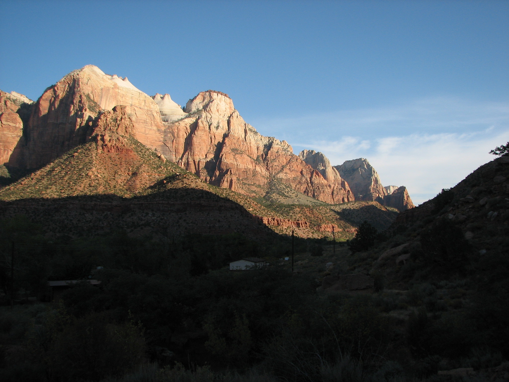
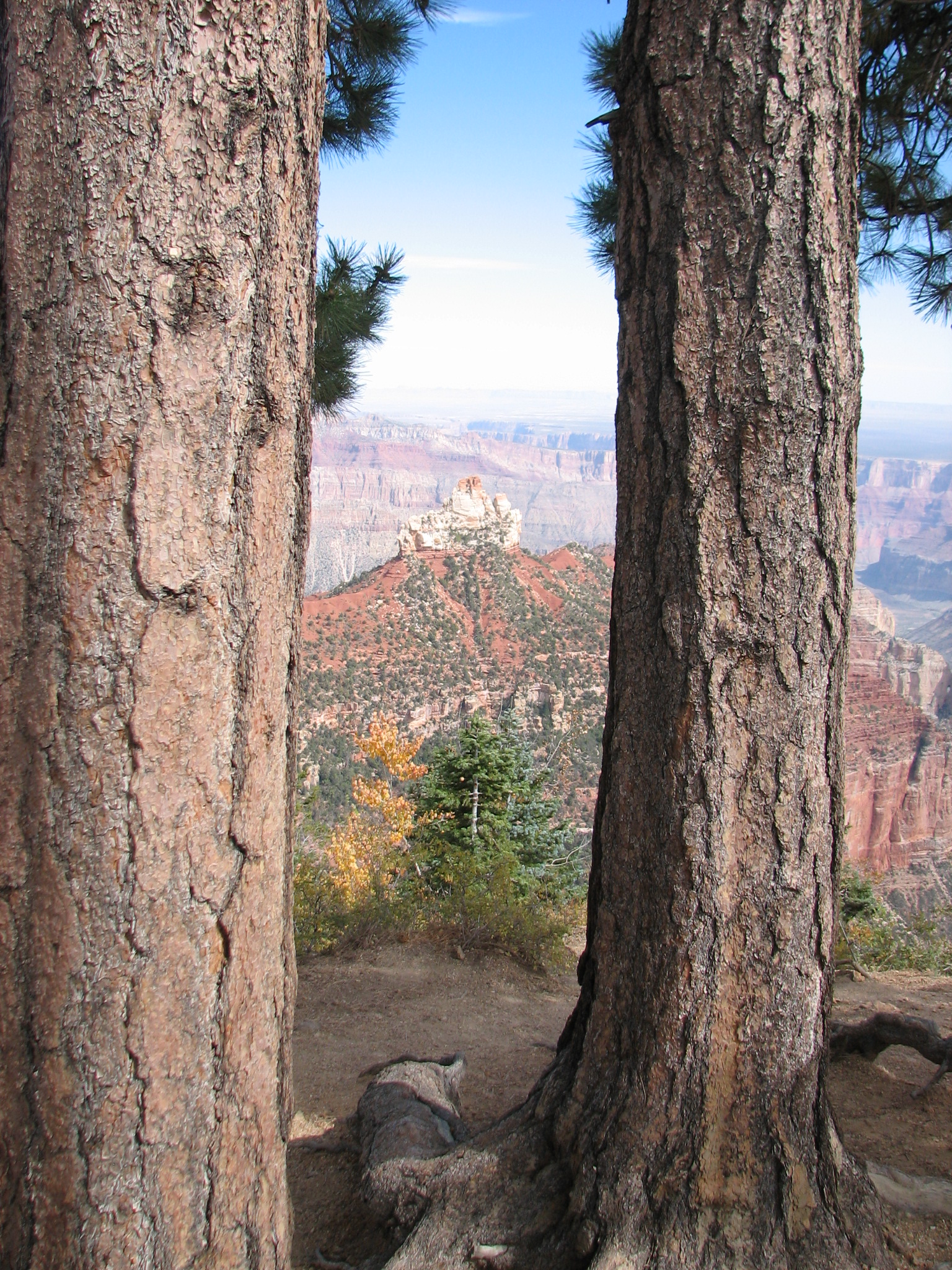 Saturday we got up early and were on the road
by 8:00 AM taking rte. 9 through Zion (a must even if you just turn around
and come back), then south on hwy 89 to Kanab, 89A to Jacob Lake, AZ and
then rte. 67 to the North Rim of the Grand Canyon. We walked the Bright Angel
trail just outside the VC, then drove to the Cape Final trailhead for a four
mile loop. Reversing our route we were back in Springdale by supper.
Saturday we got up early and were on the road
by 8:00 AM taking rte. 9 through Zion (a must even if you just turn around
and come back), then south on hwy 89 to Kanab, 89A to Jacob Lake, AZ and
then rte. 67 to the North Rim of the Grand Canyon. We walked the Bright Angel
trail just outside the VC, then drove to the Cape Final trailhead for a four
mile loop. Reversing our route we were back in Springdale by supper.
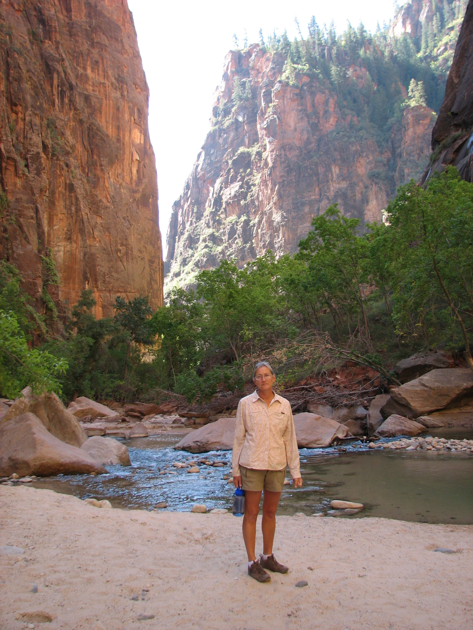 Sundays seem to deserve a late start, but we
were able to take the Zion shuttle to the last stop, Temple of Sinawa, take
the two mile Riverside walk along the Virgin River until the canyon got very
narrow and shady and cold. Then back to our room for lunch.
Sundays seem to deserve a late start, but we
were able to take the Zion shuttle to the last stop, Temple of Sinawa, take
the two mile Riverside walk along the Virgin River until the canyon got very
narrow and shady and cold. Then back to our room for lunch.
We left Zion through the park to Kanab, then to Page, AZ. From there 98, 160 and US 64 took us through ever changing territory into New Mexico where we overnighted in Bloomfield.
On October 9 we drove south on 550 to Farm road 7900 and Farm road 7950 to Chaco Canyon National Historical Park. A note of warning: the last 15 miles to Chaco is on a dusty washboard. We drove in at 10 MPH keeping our jaws clenched so our fillings would not fly out. Based on some things we heard at the Chaco Visitor Center we drove out at 50 MPH. This makes for a much smoother ride, but its hell of a test of your suspension. As we lost several lug nuts, our advice is to re-torque your wheel nuts before entering the main highway.
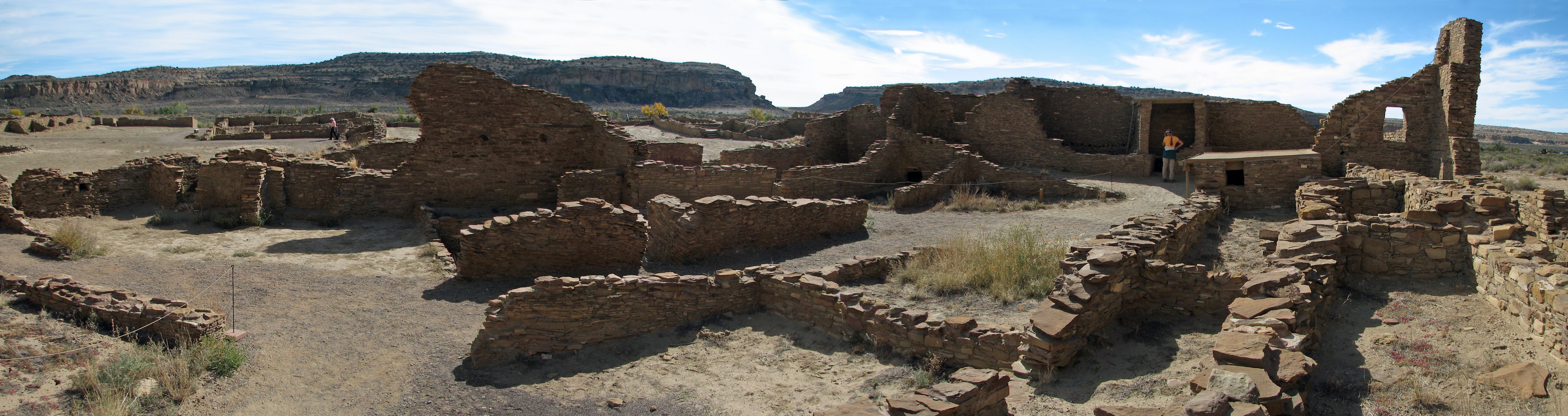
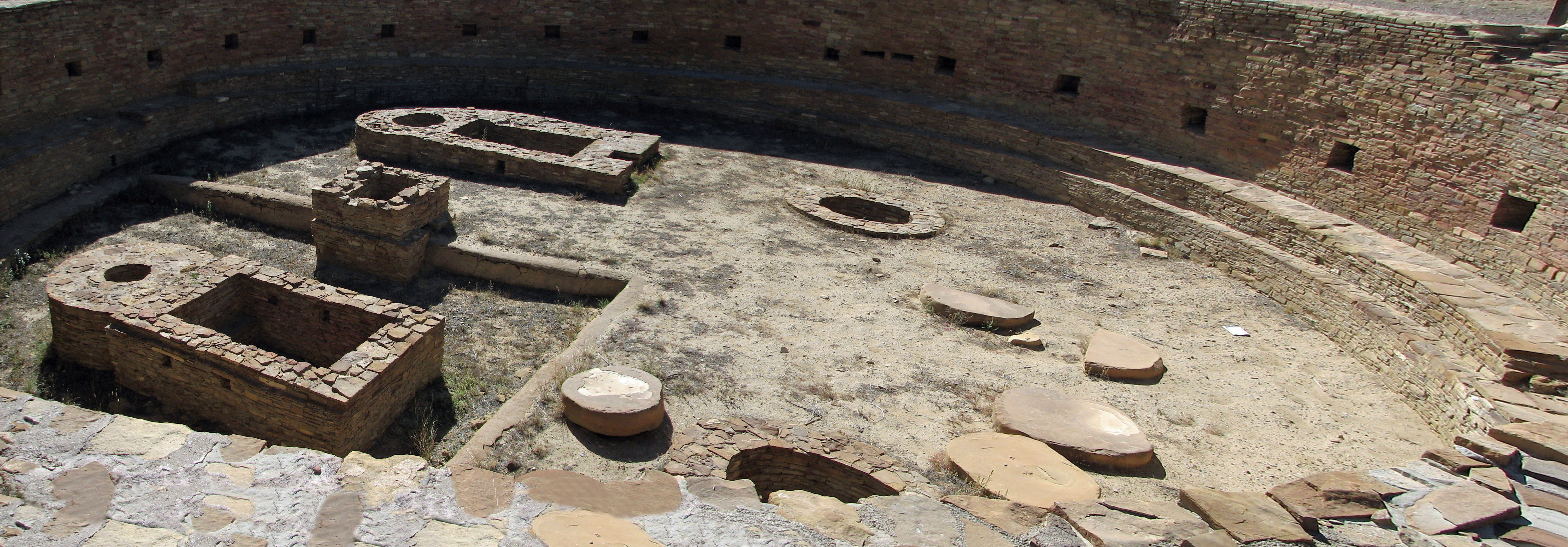
Chaco Canyon ancestral pueblo ruin Huge Kiva
Despite the road Chaco Canyon must be seen. There are a number ancestral Puebloan village sites built and lived in between 800 and 1200 AD. The hike along the cliff is recommended for its petroglyphs. The stonework is amazing as it matures through the years. Seeing the intricate positioning of living space and food storage space makes you wish you could have seen these villages in their heyday. We were able to visit most of the pueblos in one day.
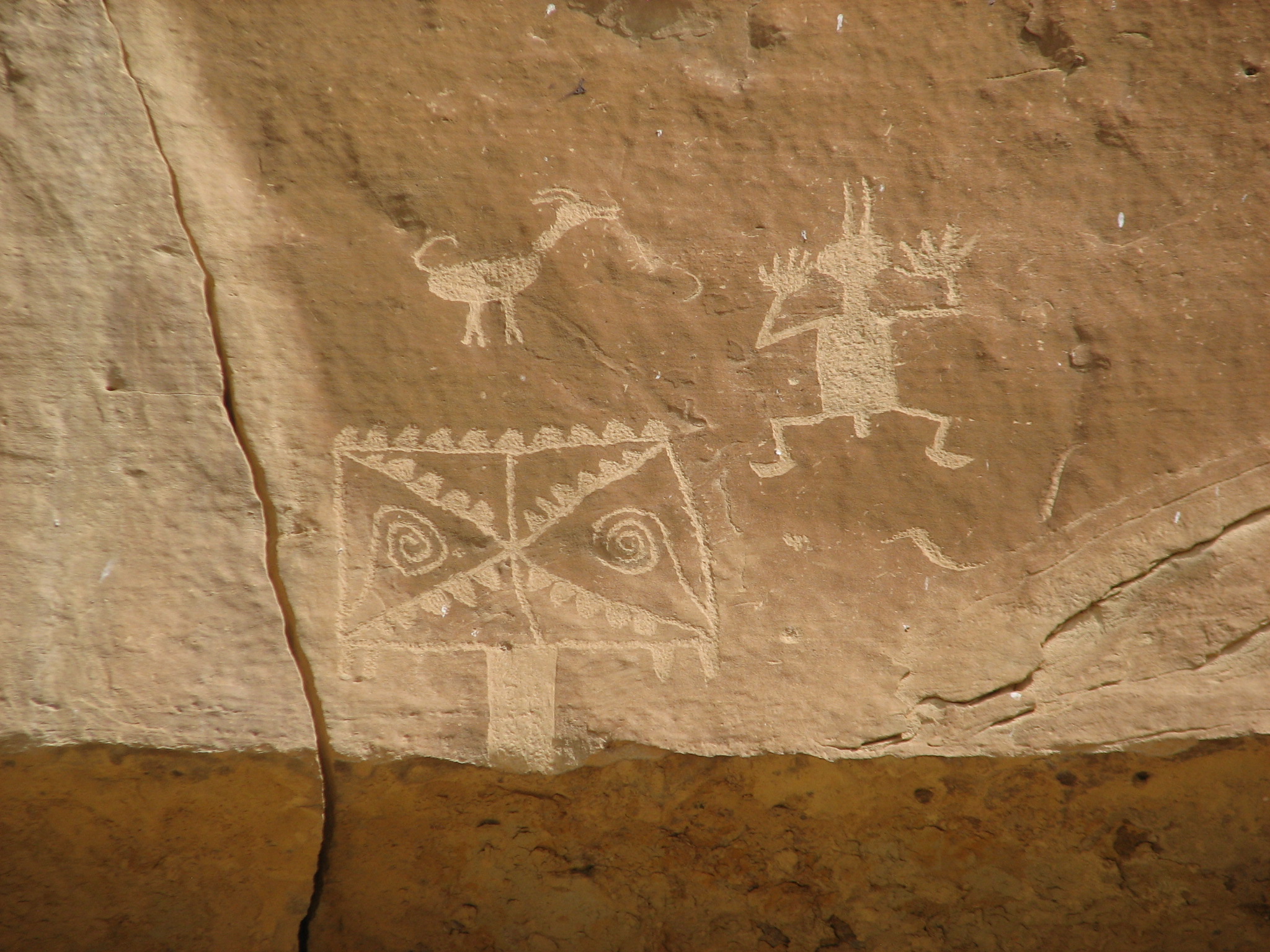
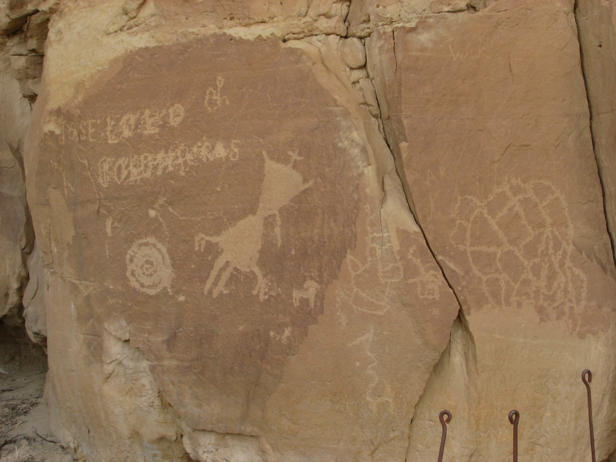
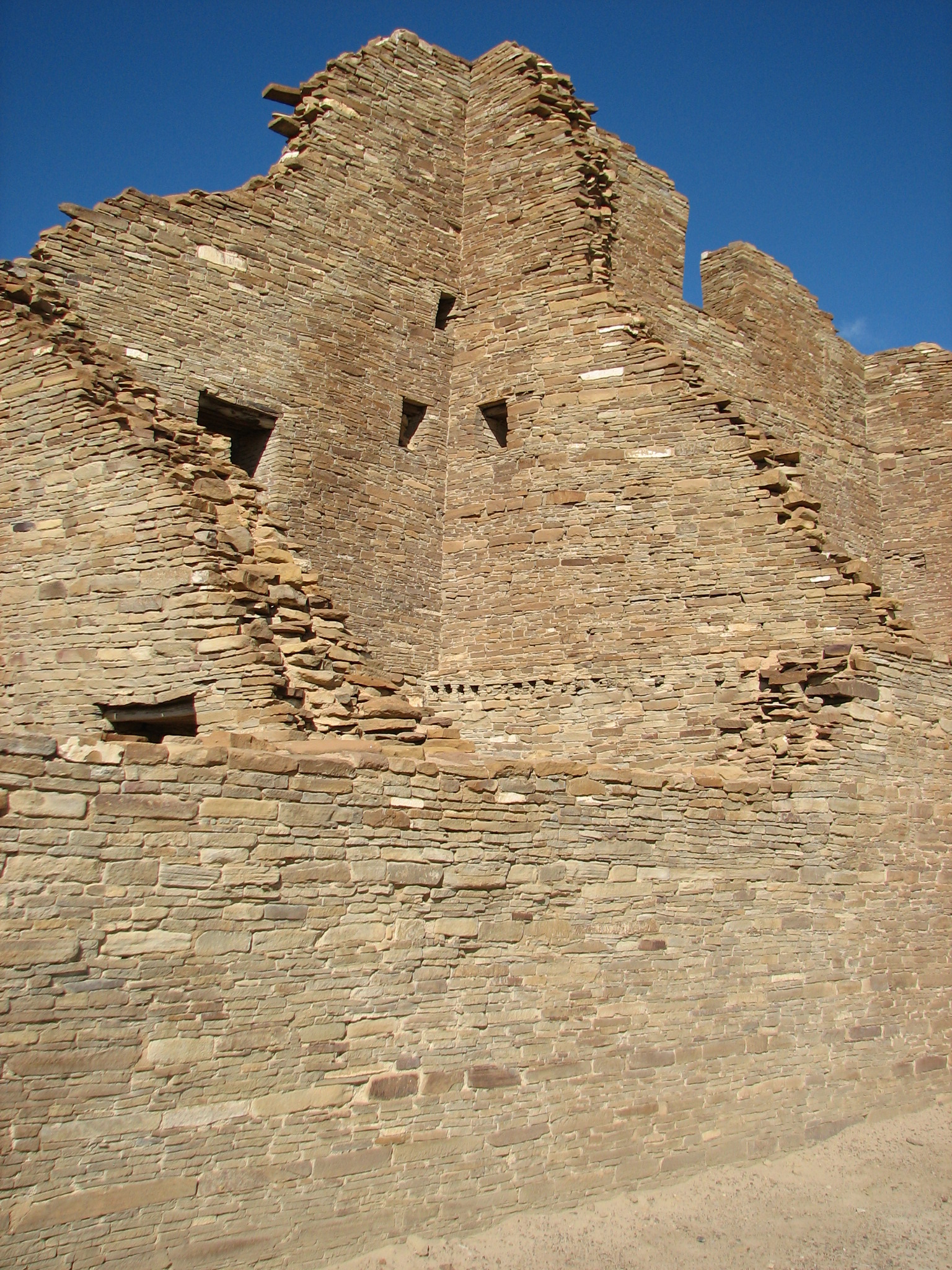
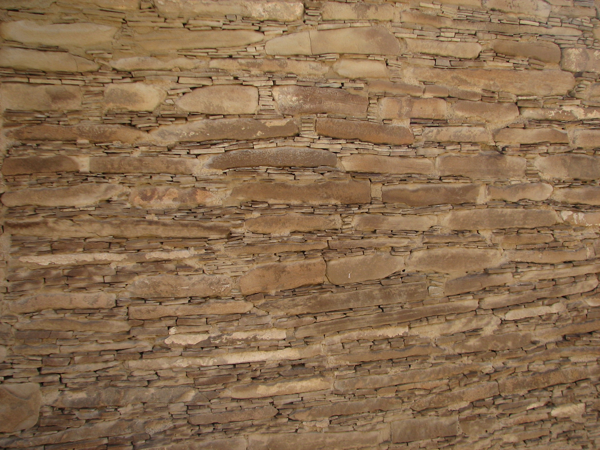
Chaco Canyon Pictographs Ancestral Pueblo Stone work detail
On Wednesday we headed to Santa Fe, detouring off 550 on rte. 4 to Battleship Rock picnic ground where we took trail 137 to McCauley Springs, a hot spring. This hike tipped us over the 100 mile mark. We could go home now. So we did.
Here is the list of trails we took. We left many others for future exploration.
| DATE | PLACE | TRAIL | MILES |
| 9/07/12 | Mesa Verde | Cliff Palace | 0.25 |
| Balcony House | 0.25 | ||
| Spruce Treehouse | 0.50 | ||
| Mesa Top | 0.50 | ||
| 9/08/12 | Hovenweep | Square Tower | 2.00 |
| Holly, Hackberry, Horseshoe | 1.50 | ||
| 9/10/12 | Natural Bridges | Sipapu/Kachina | 5.60 |
| 9/11/12 | Canyonlands | Upheaval Dome | 1.80 |
| Whale Rock | 1.20 | ||
| White Rim Overlook | 1.80 | ||
| Grandview | 2.00 | ||
| 9/13/12 | Arches | Turret, North and South Windows | 1.00 |
| Balanced Rock | 0.30 | ||
| 9/14/12 | Devil's Garden | 8.00 | |
| 9/16/12 | Goblin Valley | Entrada Canyon | 2.50 |
| 9/18/12 | Capitol Reef | Cohab Canyon | 3.50 |
| Capitol Gorge | 2.50 | ||
| 9/20/12 | Hickman Bridge | 2.00 | |
| Old Wagon Loop | 4.00 | ||
| 9/21/12 | Goosenecks, Panarama Point, Petroglyphs | 0.50 | |
| 9/22/12 | Petrified Forrest | Petrified Forrest and Spur | 1.75 |
| 9/23/12 | Calf Creek | Lower Calf Creek Falls | 5.50 |
| 9/26/12 | Kodachrome Basin | Panorama (less cool cave) | 3.50 |
| Shakespeare and Sentinel | 1.70 | ||
| Angel's Palace | 1.50 | ||
| 9/27/12 | Red Canyon | Rich and Ledge Point | 4.50 |
| Arches (at Losee Canyon trailhead) | 1.00 | ||
| 9/29/12 | Zion, N Entrance | Taylor Creek | 5.00 |
| Timber Creek Overlook | 1.00 | ||
| 9/3012 | Cedar Breaks | Alpine Pond Loop | 2.00 |
| Spectra Point | 2.00 | ||
| 10/02/12 | Snow Canyon | Hidden Piñon and Petrified Dunes | 3.00 |
| Lava Flow and Butterfly | 2.00 | ||
| 10/04/12 | Cinder Cone | 2.00 | |
| 10/05/12 | Zion, South Entrance | Watchman | 2.70 |
| Kayenta, Upper Emerald, Lower Emerald, Zion Lodge | 2.60 | ||
| 10/06/12 | Grand Canyon, N. Rim | Bright Angel Point | 0.50 |
| Roosevelt Point | 0.20 | ||
| Cape Final | 4.00 | ||
| 10/07/12 | Zion, South Entrance | Riverwalk to the Narrows | 2.20 |
| 10/09/12 | Chaco Canyon | Petroglyph Trail & road | 4.50 |
| Chetro Ketl, Pueblo Bonito | 1.75 | ||
| Pueblo de Arroyo | 0.25 | ||
| 10/10/12 | Jemez/Santa Fe NF | Trail 137, Battleship Rock Picnic area to McCauley Spring | 3.75 |
TOTAL MILES: |
100.60 |
||